You are here: Home > Network List > IU - Global Seismograph Network (GSN - IRIS/USGS) Stations List
> Station SNZO South Karori, New Zealand > Earthquake Result Viewer
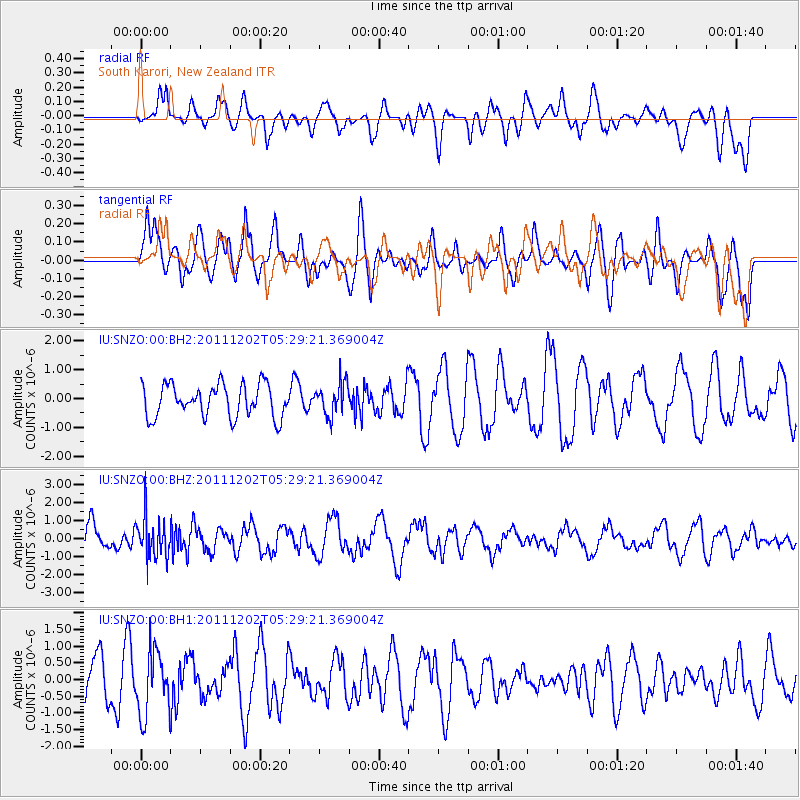
SNZO South Karori, New Zealand - Earthquake Result Viewer
*The percent match for this event was below the threshold and hence no stack was calculated.
| Earthquake location: |
Minahassa Peninsula, Sulawesi |
| Earthquake latitude/longitude: |
0.1/120.5 |
| Earthquake time(UTC): |
2011/12/02 (336) 05:19:26 GMT |
| Earthquake Depth: |
75 km |
| Earthquake Magnitude: |
5.5 MW, 5.5 MW, 5.9 MB |
| Earthquake Catalog/Contributor: |
NEIC PDE/NEIC PDE-W |
|
| Network: |
IU Global Seismograph Network (GSN - IRIS/USGS) |
| Station: |
SNZO South Karori, New Zealand |
| Lat/Lon: |
41.31 S/174.70 E |
| Elevation: |
120 m |
|
| Distance: |
63.9 deg |
| Az: |
137.141 deg |
| Baz: |
295.461 deg |
| Ray Param: |
$rayparam |
*The percent match for this event was below the threshold and hence was not used in the summary stack. |
|
| Radial Match: |
42.50135 % |
| Radial Bump: |
400 |
| Transverse Match: |
64.14086 % |
| Transverse Bump: |
400 |
| SOD ConfigId: |
510226 |
| Insert Time: |
2013-09-04 18:56:04.167 +0000 |
| GWidth: |
2.5 |
| Max Bumps: |
400 |
| Tol: |
0.001 |
|
Signal To Noise
| Channel | StoN | STA | LTA |
| IU:SNZO:00:BHZ:20111202T05:29:21.369004Z | 1.570594 | 1.1393722E-6 | 7.254404E-7 |
| IU:SNZO:00:BH1:20111202T05:29:21.369004Z | 1.499264 | 9.59158E-7 | 6.3975256E-7 |
| IU:SNZO:00:BH2:20111202T05:29:21.369004Z | 0.99168015 | 5.5953393E-7 | 5.6422823E-7 |
| Arrivals |
| Ps | |
| PpPs | |
| PsPs/PpSs | |


