You are here: Home > Network List > GT - Global Telemetered Seismograph Network (USAF/USGS) Stations List
> Station LPAZ La Paz , Bolivia > Earthquake Result Viewer
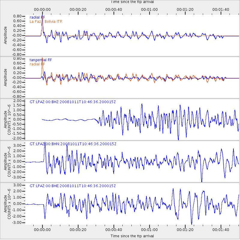
LPAZ La Paz , Bolivia - Earthquake Result Viewer
*The percent match for this event was below the threshold and hence no stack was calculated.
| Earthquake location: |
Virgin Islands |
| Earthquake latitude/longitude: |
19.2/-64.8 |
| Earthquake time(UTC): |
2008/10/11 (285) 10:40:14 GMT |
| Earthquake Depth: |
23 km |
| Earthquake Magnitude: |
6.1 MB, 5.9 MS, 6.1 MW, 6.0 MW |
| Earthquake Catalog/Contributor: |
WHDF/NEIC |
|
| Network: |
GT Global Telemetered Seismograph Network (USAF/USGS) |
| Station: |
LPAZ La Paz , Bolivia |
| Lat/Lon: |
16.17 S/68.08 W |
| Elevation: |
4817 m |
|
| Distance: |
35.3 deg |
| Az: |
185.408 deg |
| Baz: |
5.319 deg |
| Ray Param: |
$rayparam |
*The percent match for this event was below the threshold and hence was not used in the summary stack. |
|
| Radial Match: |
73.997086 % |
| Radial Bump: |
400 |
| Transverse Match: |
76.79845 % |
| Transverse Bump: |
400 |
| SOD ConfigId: |
2556 |
| Insert Time: |
2010-02-27 02:12:11.058 +0000 |
| GWidth: |
2.5 |
| Max Bumps: |
400 |
| Tol: |
0.001 |
|
Signal To Noise
| Channel | StoN | STA | LTA |
| GT:LPAZ:00:BHN:20081011T10:46:36.200015Z | 22.159348 | 1.4885613E-6 | 6.717532E-8 |
| GT:LPAZ:00:BHE:20081011T10:46:36.200015Z | 25.234825 | 9.102685E-7 | 3.6071917E-8 |
| GT:LPAZ:00:BHZ:20081011T10:46:36.200015Z | 7.540589 | 3.869926E-7 | 5.1321273E-8 |
| Arrivals |
| Ps | |
| PpPs | |
| PsPs/PpSs | |


