You are here: Home > Network List > II - Global Seismograph Network (GSN - IRIS/IDA) Stations List
> Station TAU Hobart, Tasmania, Australia > Earthquake Result Viewer
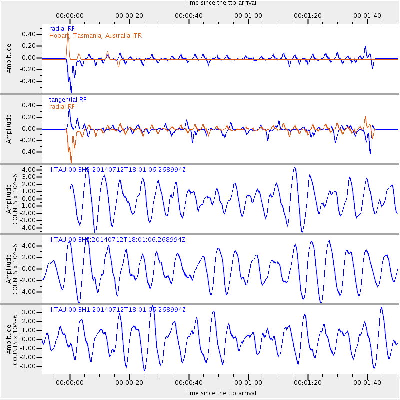
TAU Hobart, Tasmania, Australia - Earthquake Result Viewer
*The percent match for this event was below the threshold and hence no stack was calculated.
| Earthquake location: |
South Sandwich Islands Region |
| Earthquake latitude/longitude: |
-55.4/-28.0 |
| Earthquake time(UTC): |
2014/07/12 (193) 17:49:17 GMT |
| Earthquake Depth: |
5.5 km |
| Earthquake Magnitude: |
5.5 MWB |
| Earthquake Catalog/Contributor: |
NEIC PDE/NEIC COMCAT |
|
| Network: |
II Global Seismograph Network (GSN - IRIS/IDA) |
| Station: |
TAU Hobart, Tasmania, Australia |
| Lat/Lon: |
42.91 S/147.32 E |
| Elevation: |
132 m |
|
| Distance: |
82.0 deg |
| Az: |
176.536 deg |
| Baz: |
182.69 deg |
| Ray Param: |
$rayparam |
*The percent match for this event was below the threshold and hence was not used in the summary stack. |
|
| Radial Match: |
82.3168 % |
| Radial Bump: |
400 |
| Transverse Match: |
58.74775 % |
| Transverse Bump: |
397 |
| SOD ConfigId: |
3390531 |
| Insert Time: |
2019-04-12 19:49:15.282 +0000 |
| GWidth: |
2.5 |
| Max Bumps: |
400 |
| Tol: |
0.001 |
|
Signal To Noise
| Channel | StoN | STA | LTA |
| II:TAU:00:BHZ:20140712T18:01:06.268994Z | 2.9366755 | 3.7019608E-6 | 1.2605958E-6 |
| II:TAU:00:BH1:20140712T18:01:06.268994Z | 1.7766725 | 1.455515E-6 | 8.192365E-7 |
| II:TAU:00:BH2:20140712T18:01:06.268994Z | 0.66467 | 1.4896942E-6 | 2.241254E-6 |
| Arrivals |
| Ps | |
| PpPs | |
| PsPs/PpSs | |


