You are here: Home > Network List > GT - Global Telemetered Seismograph Network (USAF/USGS) Stations List
> Station LPAZ La Paz , Bolivia > Earthquake Result Viewer
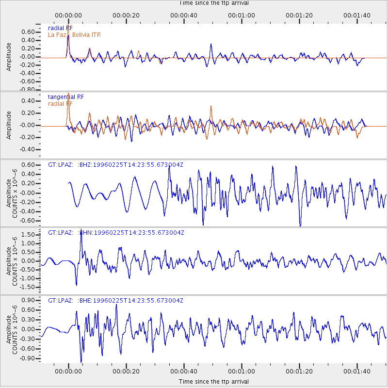
LPAZ La Paz , Bolivia - Earthquake Result Viewer
*The percent match for this event was below the threshold and hence no stack was calculated.
| Earthquake location: |
Near Coast Of Guatemala |
| Earthquake latitude/longitude: |
13.0/-91.1 |
| Earthquake time(UTC): |
1996/02/25 (056) 14:17:21 GMT |
| Earthquake Depth: |
33 km |
| Earthquake Magnitude: |
5.5 MB, 5.2 MS, 5.9 UNKNOWN, 5.8 MW |
| Earthquake Catalog/Contributor: |
WHDF/NEIC |
|
| Network: |
GT Global Telemetered Seismograph Network (USAF/USGS) |
| Station: |
LPAZ La Paz , Bolivia |
| Lat/Lon: |
16.29 S/68.13 W |
| Elevation: |
4769 m |
|
| Distance: |
36.9 deg |
| Az: |
141.471 deg |
| Baz: |
320.791 deg |
| Ray Param: |
$rayparam |
*The percent match for this event was below the threshold and hence was not used in the summary stack. |
|
| Radial Match: |
67.99525 % |
| Radial Bump: |
400 |
| Transverse Match: |
61.411736 % |
| Transverse Bump: |
400 |
| SOD ConfigId: |
4480 |
| Insert Time: |
2010-02-27 02:12:19.897 +0000 |
| GWidth: |
2.5 |
| Max Bumps: |
400 |
| Tol: |
0.001 |
|
Signal To Noise
| Channel | StoN | STA | LTA |
| GT:LPAZ: :BHN:19960225T14:23:55.673004Z | 5.711133 | 6.1683244E-7 | 1.0800526E-7 |
| GT:LPAZ: :BHE:19960225T14:23:55.673004Z | 2.8269477 | 3.4385934E-7 | 1.2163625E-7 |
| GT:LPAZ: :BHZ:19960225T14:23:55.673004Z | 1.5935959 | 2.6954203E-7 | 1.6914076E-7 |
| Arrivals |
| Ps | |
| PpPs | |
| PsPs/PpSs | |


