You are here: Home > Network List > IU - Global Seismograph Network (GSN - IRIS/USGS) Stations List
> Station HNR Honiara, Solomon Islands > Earthquake Result Viewer
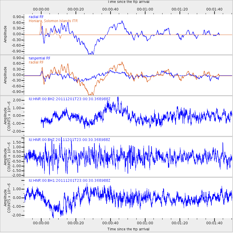
HNR Honiara, Solomon Islands - Earthquake Result Viewer
*The percent match for this event was below the threshold and hence no stack was calculated.
| Earthquake location: |
Minahassa Peninsula, Sulawesi |
| Earthquake latitude/longitude: |
-0.6/122.0 |
| Earthquake time(UTC): |
2011/12/01 (335) 22:53:36 GMT |
| Earthquake Depth: |
10 km |
| Earthquake Magnitude: |
5.7 MB |
| Earthquake Catalog/Contributor: |
NEIC PDE/NEIC PDE-W |
|
| Network: |
IU Global Seismograph Network (GSN - IRIS/USGS) |
| Station: |
HNR Honiara, Solomon Islands |
| Lat/Lon: |
9.44 S/159.95 E |
| Elevation: |
100 m |
|
| Distance: |
38.8 deg |
| Az: |
104.276 deg |
| Baz: |
280.831 deg |
| Ray Param: |
$rayparam |
*The percent match for this event was below the threshold and hence was not used in the summary stack. |
|
| Radial Match: |
38.286922 % |
| Radial Bump: |
400 |
| Transverse Match: |
40.605156 % |
| Transverse Bump: |
400 |
| SOD ConfigId: |
510410 |
| Insert Time: |
2013-09-04 19:41:52.570 +0000 |
| GWidth: |
2.5 |
| Max Bumps: |
400 |
| Tol: |
0.001 |
|
Signal To Noise
| Channel | StoN | STA | LTA |
| IU:HNR:00:BHZ:20111201T23:00:30.368988Z | 1.9885769 | 6.143647E-7 | 3.089469E-7 |
| IU:HNR:00:BH1:20111201T23:00:30.368988Z | 1.3685741 | 7.3543583E-7 | 5.373738E-7 |
| IU:HNR:00:BH2:20111201T23:00:30.368988Z | 1.0901208 | 4.6672622E-7 | 4.2814173E-7 |
| Arrivals |
| Ps | |
| PpPs | |
| PsPs/PpSs | |


