You are here: Home > Network List > GT - Global Telemetered Seismograph Network (USAF/USGS) Stations List
> Station LPAZ La Paz , Bolivia > Earthquake Result Viewer
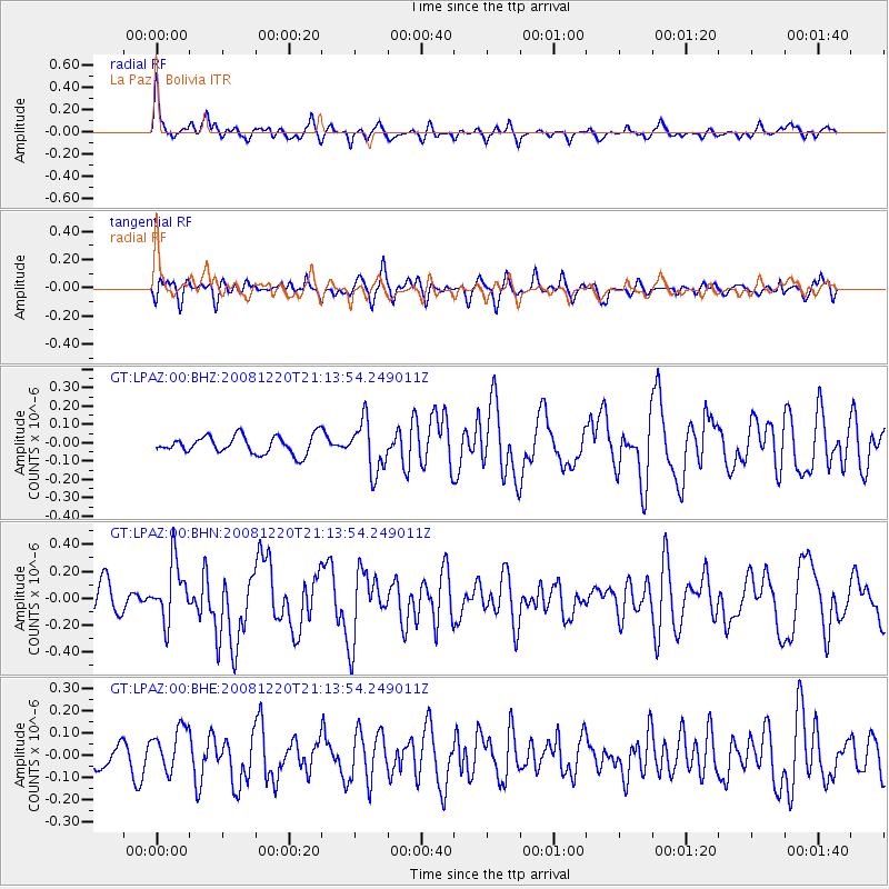
LPAZ La Paz , Bolivia - Earthquake Result Viewer
*The percent match for this event was below the threshold and hence no stack was calculated.
| Earthquake location: |
Southern Mid-Atlantic Ridge |
| Earthquake latitude/longitude: |
-31.2/-13.3 |
| Earthquake time(UTC): |
2008/12/20 (355) 21:05:16 GMT |
| Earthquake Depth: |
4.0 km |
| Earthquake Magnitude: |
5.8 MB, 5.6 MS, 5.8 MW, 5.8 MW |
| Earthquake Catalog/Contributor: |
WHDF/NEIC |
|
| Network: |
GT Global Telemetered Seismograph Network (USAF/USGS) |
| Station: |
LPAZ La Paz , Bolivia |
| Lat/Lon: |
16.17 S/68.08 W |
| Elevation: |
4817 m |
|
| Distance: |
51.8 deg |
| Az: |
273.55 deg |
| Baz: |
117.114 deg |
| Ray Param: |
$rayparam |
*The percent match for this event was below the threshold and hence was not used in the summary stack. |
|
| Radial Match: |
73.504486 % |
| Radial Bump: |
384 |
| Transverse Match: |
52.37417 % |
| Transverse Bump: |
386 |
| SOD ConfigId: |
2658 |
| Insert Time: |
2010-02-27 02:12:33.050 +0000 |
| GWidth: |
2.5 |
| Max Bumps: |
400 |
| Tol: |
0.001 |
|
Signal To Noise
| Channel | StoN | STA | LTA |
| GT:LPAZ:00:BHN:20081220T21:13:54.249011Z | 2.3312368 | 2.1600556E-7 | 9.265707E-8 |
| GT:LPAZ:00:BHE:20081220T21:13:54.249011Z | 1.2526307 | 9.8979136E-8 | 7.901701E-8 |
| GT:LPAZ:00:BHZ:20081220T21:13:54.249011Z | 2.8160622 | 1.3736526E-7 | 4.87792E-8 |
| Arrivals |
| Ps | |
| PpPs | |
| PsPs/PpSs | |


