You are here: Home > Network List > GT - Global Telemetered Seismograph Network (USAF/USGS) Stations List
> Station LPAZ La Paz , Bolivia > Earthquake Result Viewer
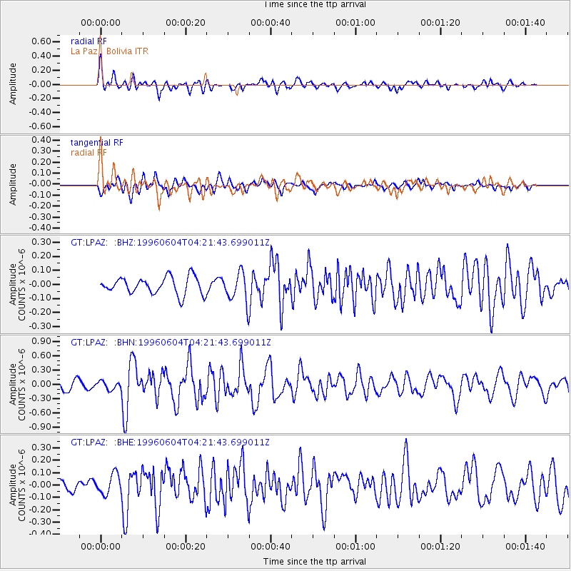
LPAZ La Paz , Bolivia - Earthquake Result Viewer
*The percent match for this event was below the threshold and hence no stack was calculated.
| Earthquake location: |
Southern East Pacific Rise |
| Earthquake latitude/longitude: |
-50.0/-114.8 |
| Earthquake time(UTC): |
1996/06/04 (156) 04:13:16 GMT |
| Earthquake Depth: |
10 km |
| Earthquake Magnitude: |
5.7 MS, 5.3 MB, 6.0 UNKNOWN, 5.9 MW |
| Earthquake Catalog/Contributor: |
WHDF/NEIC |
|
| Network: |
GT Global Telemetered Seismograph Network (USAF/USGS) |
| Station: |
LPAZ La Paz , Bolivia |
| Lat/Lon: |
16.29 S/68.13 W |
| Elevation: |
4769 m |
|
| Distance: |
50.3 deg |
| Az: |
65.12 deg |
| Baz: |
217.555 deg |
| Ray Param: |
$rayparam |
*The percent match for this event was below the threshold and hence was not used in the summary stack. |
|
| Radial Match: |
69.72967 % |
| Radial Bump: |
400 |
| Transverse Match: |
70.35638 % |
| Transverse Bump: |
400 |
| SOD ConfigId: |
4480 |
| Insert Time: |
2010-02-27 02:12:35.129 +0000 |
| GWidth: |
2.5 |
| Max Bumps: |
400 |
| Tol: |
0.001 |
|
Signal To Noise
| Channel | StoN | STA | LTA |
| GT:LPAZ: :BHN:19960604T04:21:43.699011Z | 0.9713128 | 8.758217E-8 | 9.016887E-8 |
| GT:LPAZ: :BHE:19960604T04:21:43.699011Z | 1.5300503 | 8.479209E-8 | 5.5417843E-8 |
| GT:LPAZ: :BHZ:19960604T04:21:43.699011Z | 1.3698126 | 8.075399E-8 | 5.8952587E-8 |
| Arrivals |
| Ps | |
| PpPs | |
| PsPs/PpSs | |


