You are here: Home > Network List > GS - US Geological Survey Networks Stations List
> Station DEC09 Decatur Surface Seismic Site, Decatur, IL, USA > Earthquake Result Viewer
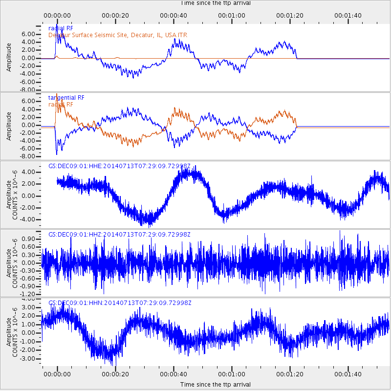
DEC09 Decatur Surface Seismic Site, Decatur, IL, USA - Earthquake Result Viewer
*The percent match for this event was below the threshold and hence no stack was calculated.
| Earthquake location: |
Chile-Argentina Border Region |
| Earthquake latitude/longitude: |
-30.6/-70.5 |
| Earthquake time(UTC): |
2014/07/13 (194) 07:18:25 GMT |
| Earthquake Depth: |
91 km |
| Earthquake Magnitude: |
5.4 MW, 5.2 mb |
| Earthquake Catalog/Contributor: |
ISC/ISC |
|
| Network: |
GS US Geological Survey Networks |
| Station: |
DEC09 Decatur Surface Seismic Site, Decatur, IL, USA |
| Lat/Lon: |
39.87 N/88.92 W |
| Elevation: |
207 m |
|
| Distance: |
72.2 deg |
| Az: |
345.161 deg |
| Baz: |
163.328 deg |
| Ray Param: |
$rayparam |
*The percent match for this event was below the threshold and hence was not used in the summary stack. |
|
| Radial Match: |
65.31655 % |
| Radial Bump: |
390 |
| Transverse Match: |
63.57947 % |
| Transverse Bump: |
366 |
| SOD ConfigId: |
3390531 |
| Insert Time: |
2019-04-12 19:56:11.746 +0000 |
| GWidth: |
2.5 |
| Max Bumps: |
400 |
| Tol: |
0.001 |
|
Signal To Noise
| Channel | StoN | STA | LTA |
| GS:DEC09:01:HHZ:20140713T07:29:09.72998Z | 1.1360104 | 3.3716233E-7 | 2.967951E-7 |
| GS:DEC09:01:HHN:20140713T07:29:09.72998Z | 2.9295306 | 3.039627E-6 | 1.0375816E-6 |
| GS:DEC09:01:HHE:20140713T07:29:09.72998Z | 3.0435014 | 4.7813473E-6 | 1.5710021E-6 |
| Arrivals |
| Ps | |
| PpPs | |
| PsPs/PpSs | |


