You are here: Home > Network List > GT - Global Telemetered Seismograph Network (USAF/USGS) Stations List
> Station LPAZ La Paz , Bolivia > Earthquake Result Viewer
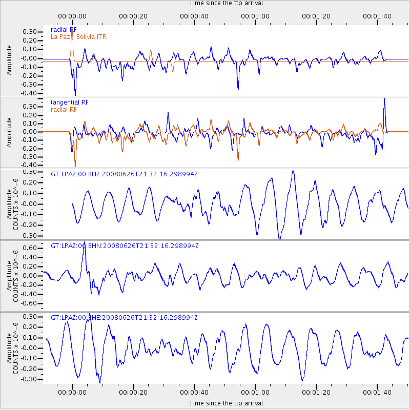
LPAZ La Paz , Bolivia - Earthquake Result Viewer
*The percent match for this event was below the threshold and hence no stack was calculated.
| Earthquake location: |
Tonga Islands |
| Earthquake latitude/longitude: |
-20.8/-173.3 |
| Earthquake time(UTC): |
2008/06/26 (178) 21:19:15 GMT |
| Earthquake Depth: |
38 km |
| Earthquake Magnitude: |
6.0 MB, 5.8 MS, 6.2 MW, 6.1 MW |
| Earthquake Catalog/Contributor: |
WHDF/NEIC |
|
| Network: |
GT Global Telemetered Seismograph Network (USAF/USGS) |
| Station: |
LPAZ La Paz , Bolivia |
| Lat/Lon: |
16.17 S/68.08 W |
| Elevation: |
4817 m |
|
| Distance: |
98.0 deg |
| Az: |
110.588 deg |
| Baz: |
245.737 deg |
| Ray Param: |
$rayparam |
*The percent match for this event was below the threshold and hence was not used in the summary stack. |
|
| Radial Match: |
44.203754 % |
| Radial Bump: |
359 |
| Transverse Match: |
63.826397 % |
| Transverse Bump: |
400 |
| SOD ConfigId: |
2504 |
| Insert Time: |
2010-02-27 02:12:43.636 +0000 |
| GWidth: |
2.5 |
| Max Bumps: |
400 |
| Tol: |
0.001 |
|
Signal To Noise
| Channel | StoN | STA | LTA |
| GT:LPAZ:00:BHN:20080626T21:32:16.298994Z | 2.035673 | 2.8759075E-7 | 1.4127552E-7 |
| GT:LPAZ:00:BHE:20080626T21:32:16.298994Z | 1.6013824 | 1.826518E-7 | 1.14058835E-7 |
| GT:LPAZ:00:BHZ:20080626T21:32:16.298994Z | 0.63211685 | 5.971122E-8 | 9.4462315E-8 |
| Arrivals |
| Ps | |
| PpPs | |
| PsPs/PpSs | |


