You are here: Home > Network List > GT - Global Telemetered Seismograph Network (USAF/USGS) Stations List
> Station LPAZ La Paz , Bolivia > Earthquake Result Viewer
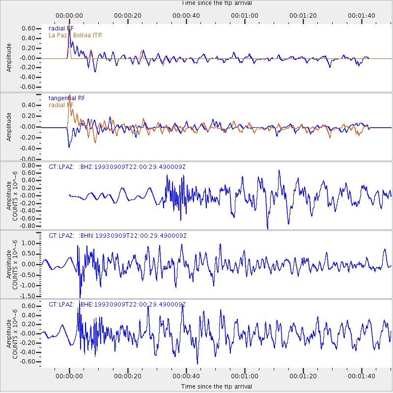
LPAZ La Paz , Bolivia - Earthquake Result Viewer
*The percent match for this event was below the threshold and hence no stack was calculated.
| Earthquake location: |
South Sandwich Islands Region |
| Earthquake latitude/longitude: |
-56.3/-27.4 |
| Earthquake time(UTC): |
1993/09/09 (252) 21:52:12 GMT |
| Earthquake Depth: |
100 km |
| Earthquake Magnitude: |
5.7 MB |
| Earthquake Catalog/Contributor: |
WHDF/NEIC |
|
| Network: |
GT Global Telemetered Seismograph Network (USAF/USGS) |
| Station: |
LPAZ La Paz , Bolivia |
| Lat/Lon: |
16.29 S/68.13 W |
| Elevation: |
4769 m |
|
| Distance: |
50.4 deg |
| Az: |
305.629 deg |
| Baz: |
151.847 deg |
| Ray Param: |
$rayparam |
*The percent match for this event was below the threshold and hence was not used in the summary stack. |
|
| Radial Match: |
66.05659 % |
| Radial Bump: |
400 |
| Transverse Match: |
66.2253 % |
| Transverse Bump: |
400 |
| SOD ConfigId: |
4480 |
| Insert Time: |
2010-02-27 02:12:45.528 +0000 |
| GWidth: |
2.5 |
| Max Bumps: |
400 |
| Tol: |
0.001 |
|
Signal To Noise
| Channel | StoN | STA | LTA |
| GT:LPAZ: :BHN:19930909T22:00:29.490009Z | 4.4192243 | 4.9796387E-7 | 1.1268129E-7 |
| GT:LPAZ: :BHE:19930909T22:00:29.490009Z | 2.9315774 | 2.3244083E-7 | 7.9288654E-8 |
| GT:LPAZ: :BHZ:19930909T22:00:29.490009Z | 2.5010216 | 2.0646918E-7 | 8.255394E-8 |
| Arrivals |
| Ps | |
| PpPs | |
| PsPs/PpSs | |


