You are here: Home > Network List > GT - Global Telemetered Seismograph Network (USAF/USGS) Stations List
> Station LPAZ La Paz , Bolivia > Earthquake Result Viewer
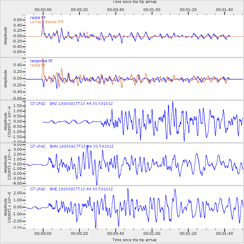
LPAZ La Paz , Bolivia - Earthquake Result Viewer
*The percent match for this event was below the threshold and hence no stack was calculated.
| Earthquake location: |
South Atlantic Ocean |
| Earthquake latitude/longitude: |
-53.6/-51.5 |
| Earthquake time(UTC): |
1993/09/27 (270) 13:37:32 GMT |
| Earthquake Depth: |
33 km |
| Earthquake Magnitude: |
6.1 MB, 6.4 MS, 6.3 UNKNOWN, 6.7 MW |
| Earthquake Catalog/Contributor: |
WHDF/NEIC |
|
| Network: |
GT Global Telemetered Seismograph Network (USAF/USGS) |
| Station: |
LPAZ La Paz , Bolivia |
| Lat/Lon: |
16.29 S/68.13 W |
| Elevation: |
4769 m |
|
| Distance: |
39.5 deg |
| Az: |
334.417 deg |
| Baz: |
164.474 deg |
| Ray Param: |
$rayparam |
*The percent match for this event was below the threshold and hence was not used in the summary stack. |
|
| Radial Match: |
72.77779 % |
| Radial Bump: |
400 |
| Transverse Match: |
69.43864 % |
| Transverse Bump: |
400 |
| SOD ConfigId: |
4480 |
| Insert Time: |
2010-02-27 02:12:49.541 +0000 |
| GWidth: |
2.5 |
| Max Bumps: |
400 |
| Tol: |
0.001 |
|
Signal To Noise
| Channel | StoN | STA | LTA |
| GT:LPAZ: :BHN:19930927T13:44:30.59101Z | 8.280419 | 6.2692334E-7 | 7.571154E-8 |
| GT:LPAZ: :BHE:19930927T13:44:30.59101Z | 5.1095343 | 2.4700228E-7 | 4.8341445E-8 |
| GT:LPAZ: :BHZ:19930927T13:44:30.59101Z | 1.729787 | 1.5527166E-7 | 8.976346E-8 |
| Arrivals |
| Ps | |
| PpPs | |
| PsPs/PpSs | |


