You are here: Home > Network List > GT - Global Telemetered Seismograph Network (USAF/USGS) Stations List
> Station LPAZ La Paz , Bolivia > Earthquake Result Viewer
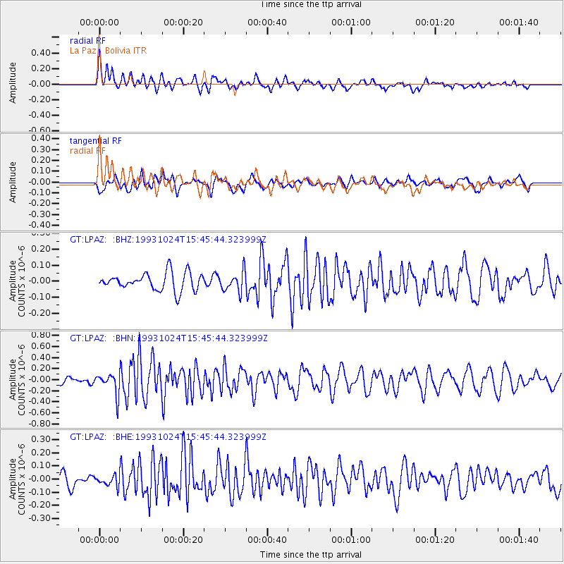
LPAZ La Paz , Bolivia - Earthquake Result Viewer
*The percent match for this event was below the threshold and hence no stack was calculated.
| Earthquake location: |
Pacific-Antarctic Ridge |
| Earthquake latitude/longitude: |
-55.6/-128.2 |
| Earthquake time(UTC): |
1993/10/24 (297) 15:36:08 GMT |
| Earthquake Depth: |
10 km |
| Earthquake Magnitude: |
5.5 MS, 5.3 MB |
| Earthquake Catalog/Contributor: |
WHDF/NEIC |
|
| Network: |
GT Global Telemetered Seismograph Network (USAF/USGS) |
| Station: |
LPAZ La Paz , Bolivia |
| Lat/Lon: |
16.29 S/68.13 W |
| Elevation: |
4769 m |
|
| Distance: |
59.9 deg |
| Az: |
74.115 deg |
| Baz: |
214.61 deg |
| Ray Param: |
$rayparam |
*The percent match for this event was below the threshold and hence was not used in the summary stack. |
|
| Radial Match: |
73.08149 % |
| Radial Bump: |
400 |
| Transverse Match: |
56.895298 % |
| Transverse Bump: |
400 |
| SOD ConfigId: |
4480 |
| Insert Time: |
2010-02-27 02:12:51.838 +0000 |
| GWidth: |
2.5 |
| Max Bumps: |
400 |
| Tol: |
0.001 |
|
Signal To Noise
| Channel | StoN | STA | LTA |
| GT:LPAZ: :BHN:19931024T15:45:44.323999Z | 3.577553 | 1.9530965E-7 | 5.459308E-8 |
| GT:LPAZ: :BHE:19931024T15:45:44.323999Z | 0.9987904 | 4.0976154E-8 | 4.1025782E-8 |
| GT:LPAZ: :BHZ:19931024T15:45:44.323999Z | 0.8520442 | 4.715958E-8 | 5.5348746E-8 |
| Arrivals |
| Ps | |
| PpPs | |
| PsPs/PpSs | |


