You are here: Home > Network List > TA - USArray Transportable Network (new EarthScope stations) Stations List
> Station K39A Oelwein, IA, USA > Earthquake Result Viewer
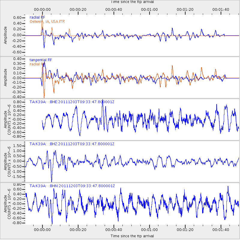
K39A Oelwein, IA, USA - Earthquake Result Viewer
*The percent match for this event was below the threshold and hence no stack was calculated.
| Earthquake location: |
Leeward Islands |
| Earthquake latitude/longitude: |
18.0/-59.8 |
| Earthquake time(UTC): |
2011/12/03 (337) 09:27:11 GMT |
| Earthquake Depth: |
10 km |
| Earthquake Magnitude: |
5.6 MW, 5.2 MS, 5.4 MB, 5.6 MW |
| Earthquake Catalog/Contributor: |
WHDF/NEIC |
|
| Network: |
TA USArray Transportable Network (new EarthScope stations) |
| Station: |
K39A Oelwein, IA, USA |
| Lat/Lon: |
42.71 N/91.89 W |
| Elevation: |
332 m |
|
| Distance: |
36.7 deg |
| Az: |
319.096 deg |
| Baz: |
122.262 deg |
| Ray Param: |
$rayparam |
*The percent match for this event was below the threshold and hence was not used in the summary stack. |
|
| Radial Match: |
70.87437 % |
| Radial Bump: |
400 |
| Transverse Match: |
59.922626 % |
| Transverse Bump: |
400 |
| SOD ConfigId: |
510410 |
| Insert Time: |
2013-09-04 20:25:13.800 +0000 |
| GWidth: |
2.5 |
| Max Bumps: |
400 |
| Tol: |
0.001 |
|
Signal To Noise
| Channel | StoN | STA | LTA |
| TA:K39A: :BHZ:20111203T09:33:47.800001Z | 1.5079653 | 4.473368E-7 | 2.9664926E-7 |
| TA:K39A: :BHN:20111203T09:33:47.800001Z | 0.9873364 | 2.2793074E-7 | 2.308542E-7 |
| TA:K39A: :BHE:20111203T09:33:47.800001Z | 1.152716 | 3.419648E-7 | 2.9666006E-7 |
| Arrivals |
| Ps | |
| PpPs | |
| PsPs/PpSs | |


