You are here: Home > Network List > TA - USArray Transportable Network (new EarthScope stations) Stations List
> Station L39A Vinton, IA, USA > Earthquake Result Viewer
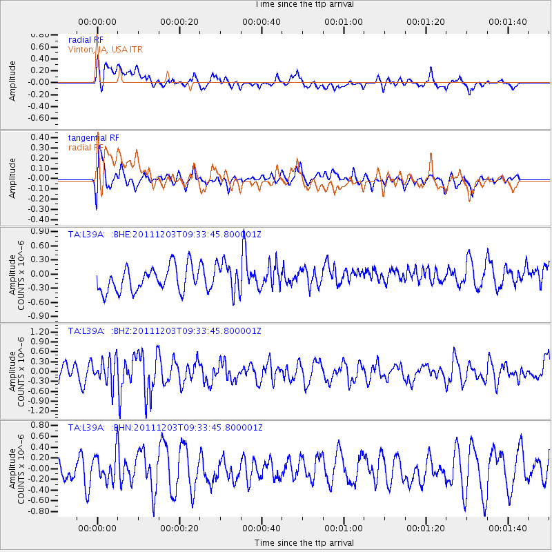
L39A Vinton, IA, USA - Earthquake Result Viewer
*The percent match for this event was below the threshold and hence no stack was calculated.
| Earthquake location: |
Leeward Islands |
| Earthquake latitude/longitude: |
18.0/-59.8 |
| Earthquake time(UTC): |
2011/12/03 (337) 09:27:11 GMT |
| Earthquake Depth: |
10 km |
| Earthquake Magnitude: |
5.6 MW, 5.2 MS, 5.4 MB, 5.6 MW |
| Earthquake Catalog/Contributor: |
WHDF/NEIC |
|
| Network: |
TA USArray Transportable Network (new EarthScope stations) |
| Station: |
L39A Vinton, IA, USA |
| Lat/Lon: |
42.12 N/92.00 W |
| Elevation: |
261 m |
|
| Distance: |
36.5 deg |
| Az: |
318.194 deg |
| Baz: |
121.462 deg |
| Ray Param: |
$rayparam |
*The percent match for this event was below the threshold and hence was not used in the summary stack. |
|
| Radial Match: |
45.04895 % |
| Radial Bump: |
400 |
| Transverse Match: |
58.495625 % |
| Transverse Bump: |
400 |
| SOD ConfigId: |
510410 |
| Insert Time: |
2013-09-04 20:25:46.737 +0000 |
| GWidth: |
2.5 |
| Max Bumps: |
400 |
| Tol: |
0.001 |
|
Signal To Noise
| Channel | StoN | STA | LTA |
| TA:L39A: :BHZ:20111203T09:33:45.800001Z | 1.425748 | 3.8319865E-7 | 2.6877026E-7 |
| TA:L39A: :BHN:20111203T09:33:45.800001Z | 1.023229 | 2.5876517E-7 | 2.5289077E-7 |
| TA:L39A: :BHE:20111203T09:33:45.800001Z | 1.2611663 | 3.287307E-7 | 2.6065612E-7 |
| Arrivals |
| Ps | |
| PpPs | |
| PsPs/PpSs | |


