You are here: Home > Network List > GT - Global Telemetered Seismograph Network (USAF/USGS) Stations List
> Station LPAZ La Paz , Bolivia > Earthquake Result Viewer
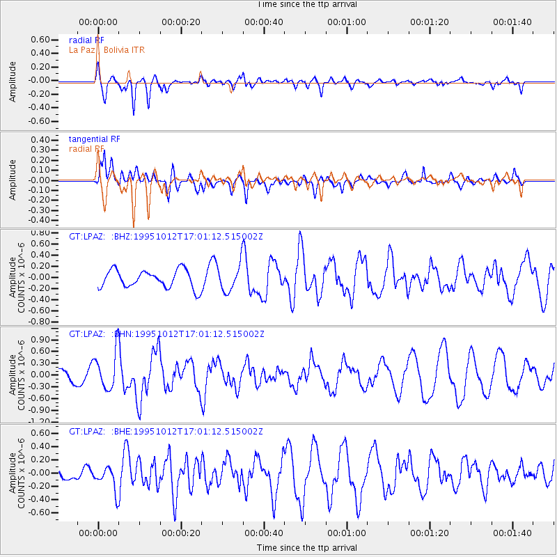
LPAZ La Paz , Bolivia - Earthquake Result Viewer
*The percent match for this event was below the threshold and hence no stack was calculated.
| Earthquake location: |
Near Coast Of Jalisco, Mexico |
| Earthquake latitude/longitude: |
18.8/-104.0 |
| Earthquake time(UTC): |
1995/10/12 (285) 16:52:54 GMT |
| Earthquake Depth: |
25 km |
| Earthquake Magnitude: |
5.5 MB, 5.5 MS, 5.2 UNKNOWN, 6.0 MW |
| Earthquake Catalog/Contributor: |
WHDF/NEIC |
|
| Network: |
GT Global Telemetered Seismograph Network (USAF/USGS) |
| Station: |
LPAZ La Paz , Bolivia |
| Lat/Lon: |
16.29 S/68.13 W |
| Elevation: |
4769 m |
|
| Distance: |
49.6 deg |
| Az: |
132.383 deg |
| Baz: |
313.242 deg |
| Ray Param: |
$rayparam |
*The percent match for this event was below the threshold and hence was not used in the summary stack. |
|
| Radial Match: |
68.450645 % |
| Radial Bump: |
400 |
| Transverse Match: |
50.449352 % |
| Transverse Bump: |
400 |
| SOD ConfigId: |
4480 |
| Insert Time: |
2010-02-27 02:12:57.282 +0000 |
| GWidth: |
2.5 |
| Max Bumps: |
400 |
| Tol: |
0.001 |
|
Signal To Noise
| Channel | StoN | STA | LTA |
| GT:LPAZ: :BHN:19951012T17:01:12.515002Z | 2.8921242 | 4.9739265E-7 | 1.7198178E-7 |
| GT:LPAZ: :BHE:19951012T17:01:12.515002Z | 1.25893 | 1.9061315E-7 | 1.5140887E-7 |
| GT:LPAZ: :BHZ:19951012T17:01:12.515002Z | 1.8093092 | 2.9061133E-7 | 1.6062005E-7 |
| Arrivals |
| Ps | |
| PpPs | |
| PsPs/PpSs | |


