You are here: Home > Network List > TA - USArray Transportable Network (new EarthScope stations) Stations List
> Station E62A Clayton Lake, ME, USA > Earthquake Result Viewer
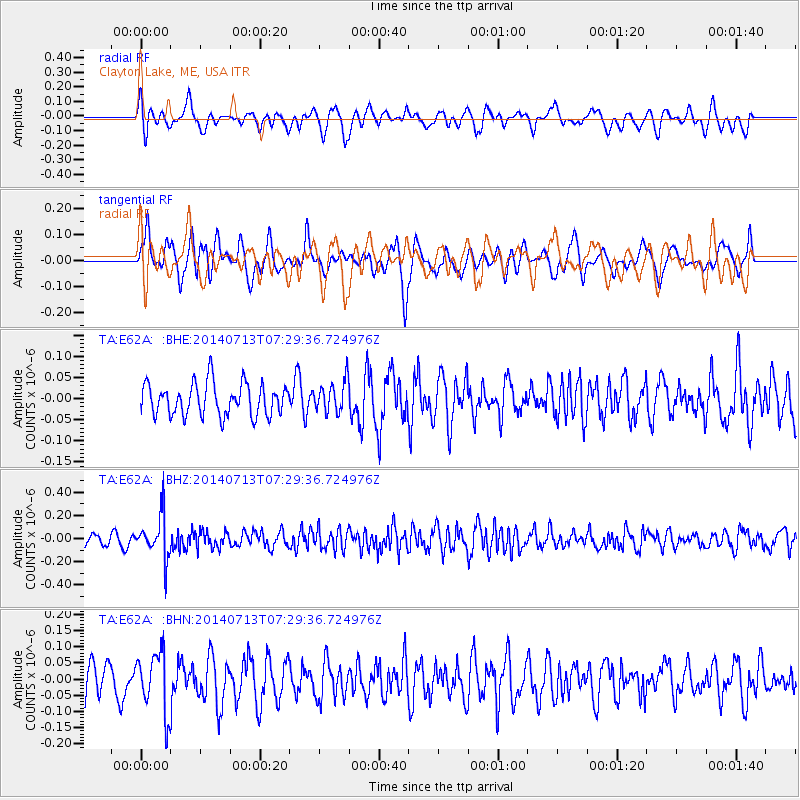
E62A Clayton Lake, ME, USA - Earthquake Result Viewer
*The percent match for this event was below the threshold and hence no stack was calculated.
| Earthquake location: |
Chile-Argentina Border Region |
| Earthquake latitude/longitude: |
-30.6/-70.5 |
| Earthquake time(UTC): |
2014/07/13 (194) 07:18:25 GMT |
| Earthquake Depth: |
91 km |
| Earthquake Magnitude: |
5.4 MW, 5.2 mb |
| Earthquake Catalog/Contributor: |
ISC/ISC |
|
| Network: |
TA USArray Transportable Network (new EarthScope stations) |
| Station: |
E62A Clayton Lake, ME, USA |
| Lat/Lon: |
46.62 N/69.52 W |
| Elevation: |
356 m |
|
| Distance: |
76.9 deg |
| Az: |
0.657 deg |
| Baz: |
180.822 deg |
| Ray Param: |
$rayparam |
*The percent match for this event was below the threshold and hence was not used in the summary stack. |
|
| Radial Match: |
51.040817 % |
| Radial Bump: |
400 |
| Transverse Match: |
53.312965 % |
| Transverse Bump: |
400 |
| SOD ConfigId: |
3390531 |
| Insert Time: |
2019-04-12 19:59:27.732 +0000 |
| GWidth: |
2.5 |
| Max Bumps: |
400 |
| Tol: |
0.001 |
|
Signal To Noise
| Channel | StoN | STA | LTA |
| TA:E62A: :BHZ:20140713T07:29:36.724976Z | 3.8863714 | 1.8129418E-7 | 4.66487E-8 |
| TA:E62A: :BHN:20140713T07:29:36.724976Z | 1.7740813 | 9.303103E-8 | 5.2438992E-8 |
| TA:E62A: :BHE:20140713T07:29:36.724976Z | 0.95449954 | 3.6461316E-8 | 3.8199406E-8 |
| Arrivals |
| Ps | |
| PpPs | |
| PsPs/PpSs | |


