You are here: Home > Network List > TA - USArray Transportable Network (new EarthScope stations) Stations List
> Station G59A Clarenceville, QC, USA > Earthquake Result Viewer
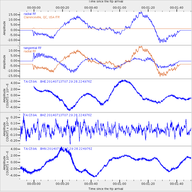
G59A Clarenceville, QC, USA - Earthquake Result Viewer
*The percent match for this event was below the threshold and hence no stack was calculated.
| Earthquake location: |
Chile-Argentina Border Region |
| Earthquake latitude/longitude: |
-30.6/-70.5 |
| Earthquake time(UTC): |
2014/07/13 (194) 07:18:25 GMT |
| Earthquake Depth: |
91 km |
| Earthquake Magnitude: |
5.4 MW, 5.2 mb |
| Earthquake Catalog/Contributor: |
ISC/ISC |
|
| Network: |
TA USArray Transportable Network (new EarthScope stations) |
| Station: |
G59A Clarenceville, QC, USA |
| Lat/Lon: |
45.08 N/73.18 W |
| Elevation: |
36 m |
|
| Distance: |
75.4 deg |
| Az: |
358.002 deg |
| Baz: |
177.568 deg |
| Ray Param: |
$rayparam |
*The percent match for this event was below the threshold and hence was not used in the summary stack. |
|
| Radial Match: |
36.63831 % |
| Radial Bump: |
400 |
| Transverse Match: |
43.879654 % |
| Transverse Bump: |
400 |
| SOD ConfigId: |
3390531 |
| Insert Time: |
2019-04-12 19:59:39.829 +0000 |
| GWidth: |
2.5 |
| Max Bumps: |
400 |
| Tol: |
0.001 |
|
Signal To Noise
| Channel | StoN | STA | LTA |
| TA:G59A: :BHZ:20140713T07:29:28.224976Z | 1.1930825 | 8.6368864E-8 | 7.2391366E-8 |
| TA:G59A: :BHN:20140713T07:29:28.224976Z | 1.1738609 | 6.1391365E-6 | 5.2298674E-6 |
| TA:G59A: :BHE:20140713T07:29:28.224976Z | 0.8110411 | 1.6630497E-6 | 2.0505122E-6 |
| Arrivals |
| Ps | |
| PpPs | |
| PsPs/PpSs | |


