You are here: Home > Network List > GT - Global Telemetered Seismograph Network (USAF/USGS) Stations List
> Station LPAZ La Paz , Bolivia > Earthquake Result Viewer
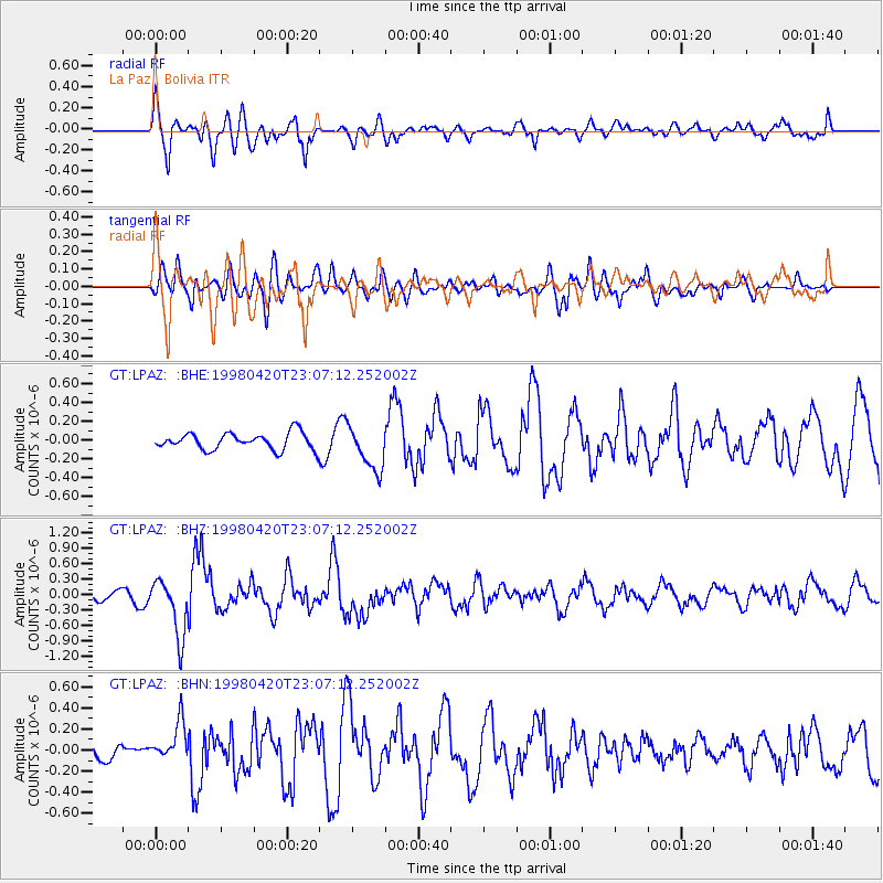
LPAZ La Paz , Bolivia - Earthquake Result Viewer
*The percent match for this event was below the threshold and hence no stack was calculated.
| Earthquake location: |
Guerrero, Mexico |
| Earthquake latitude/longitude: |
18.5/-101.2 |
| Earthquake time(UTC): |
1998/04/20 (110) 22:59:14 GMT |
| Earthquake Depth: |
67 km |
| Earthquake Magnitude: |
5.9 MB, 6.0 UNKNOWN, 5.9 MW |
| Earthquake Catalog/Contributor: |
WHDF/NEIC |
|
| Network: |
GT Global Telemetered Seismograph Network (USAF/USGS) |
| Station: |
LPAZ La Paz , Bolivia |
| Lat/Lon: |
16.29 S/68.13 W |
| Elevation: |
4769 m |
|
| Distance: |
47.5 deg |
| Az: |
134.7 deg |
| Baz: |
315.392 deg |
| Ray Param: |
$rayparam |
*The percent match for this event was below the threshold and hence was not used in the summary stack. |
|
| Radial Match: |
79.46682 % |
| Radial Bump: |
400 |
| Transverse Match: |
61.98204 % |
| Transverse Bump: |
400 |
| SOD ConfigId: |
4480 |
| Insert Time: |
2010-02-27 02:13:05.655 +0000 |
| GWidth: |
2.5 |
| Max Bumps: |
400 |
| Tol: |
0.001 |
|
Signal To Noise
| Channel | StoN | STA | LTA |
| GT:LPAZ: :BHZ:19980420T23:07:12.252002Z | 3.3549378 | 5.5506035E-7 | 1.6544578E-7 |
| GT:LPAZ: :BHN:19980420T23:07:12.252002Z | 1.619696 | 1.9130506E-7 | 1.1811171E-7 |
| GT:LPAZ: :BHE:19980420T23:07:12.252002Z | 2.5444179 | 2.3292928E-7 | 9.154522E-8 |
| Arrivals |
| Ps | |
| PpPs | |
| PsPs/PpSs | |


