You are here: Home > Network List > TA - USArray Transportable Network (new EarthScope stations) Stations List
> Station T56A Rocky Mt, VA, USA > Earthquake Result Viewer
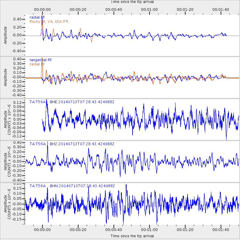
T56A Rocky Mt, VA, USA - Earthquake Result Viewer
*The percent match for this event was below the threshold and hence no stack was calculated.
| Earthquake location: |
Chile-Argentina Border Region |
| Earthquake latitude/longitude: |
-30.6/-70.5 |
| Earthquake time(UTC): |
2014/07/13 (194) 07:18:25 GMT |
| Earthquake Depth: |
91 km |
| Earthquake Magnitude: |
5.4 MW, 5.2 mb |
| Earthquake Catalog/Contributor: |
ISC/ISC |
|
| Network: |
TA USArray Transportable Network (new EarthScope stations) |
| Station: |
T56A Rocky Mt, VA, USA |
| Lat/Lon: |
37.03 N/80.03 W |
| Elevation: |
387 m |
|
| Distance: |
67.9 deg |
| Az: |
351.734 deg |
| Baz: |
171.091 deg |
| Ray Param: |
$rayparam |
*The percent match for this event was below the threshold and hence was not used in the summary stack. |
|
| Radial Match: |
67.59074 % |
| Radial Bump: |
400 |
| Transverse Match: |
48.989403 % |
| Transverse Bump: |
400 |
| SOD ConfigId: |
3390531 |
| Insert Time: |
2019-04-12 20:00:50.540 +0000 |
| GWidth: |
2.5 |
| Max Bumps: |
400 |
| Tol: |
0.001 |
|
Signal To Noise
| Channel | StoN | STA | LTA |
| TA:T56A: :BHZ:20140713T07:28:43.424988Z | 2.2618632 | 1.0309469E-7 | 4.5579544E-8 |
| TA:T56A: :BHN:20140713T07:28:43.424988Z | 1.8585618 | 5.581418E-8 | 3.0030847E-8 |
| TA:T56A: :BHE:20140713T07:28:43.424988Z | 0.65329546 | 2.6252222E-8 | 4.01843E-8 |
| Arrivals |
| Ps | |
| PpPs | |
| PsPs/PpSs | |


