You are here: Home > Network List > US - United States National Seismic Network Stations List
> Station DGMT Dagmar, Montana, USA > Earthquake Result Viewer
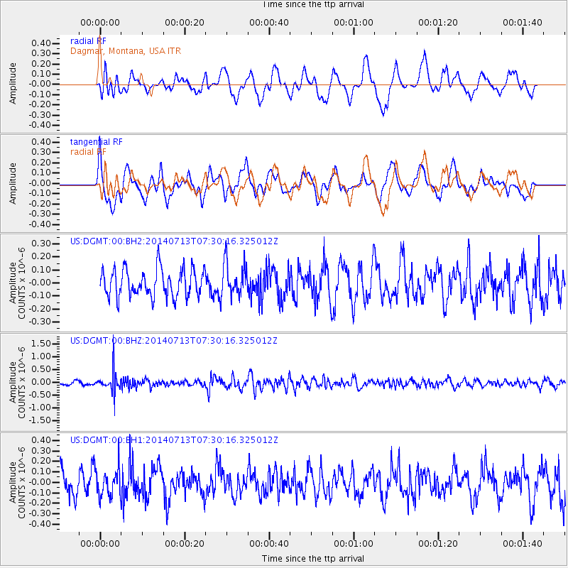
DGMT Dagmar, Montana, USA - Earthquake Result Viewer
*The percent match for this event was below the threshold and hence no stack was calculated.
| Earthquake location: |
Chile-Argentina Border Region |
| Earthquake latitude/longitude: |
-30.6/-70.5 |
| Earthquake time(UTC): |
2014/07/13 (194) 07:18:25 GMT |
| Earthquake Depth: |
91 km |
| Earthquake Magnitude: |
5.4 MW, 5.2 mb |
| Earthquake Catalog/Contributor: |
ISC/ISC |
|
| Network: |
US United States National Seismic Network |
| Station: |
DGMT Dagmar, Montana, USA |
| Lat/Lon: |
48.47 N/104.20 W |
| Elevation: |
0.0 m |
|
| Distance: |
84.3 deg |
| Az: |
338.192 deg |
| Baz: |
151.233 deg |
| Ray Param: |
$rayparam |
*The percent match for this event was below the threshold and hence was not used in the summary stack. |
|
| Radial Match: |
56.297726 % |
| Radial Bump: |
400 |
| Transverse Match: |
54.87375 % |
| Transverse Bump: |
400 |
| SOD ConfigId: |
3390531 |
| Insert Time: |
2019-04-12 20:01:37.614 +0000 |
| GWidth: |
2.5 |
| Max Bumps: |
400 |
| Tol: |
0.001 |
|
Signal To Noise
| Channel | StoN | STA | LTA |
| US:DGMT:00:BHZ:20140713T07:30:16.325012Z | 5.5967174 | 4.00464E-7 | 7.155337E-8 |
| US:DGMT:00:BH1:20140713T07:30:16.325012Z | 1.0249177 | 1.2860515E-7 | 1.2547852E-7 |
| US:DGMT:00:BH2:20140713T07:30:16.325012Z | 1.191631 | 1.247789E-7 | 1.0471269E-7 |
| Arrivals |
| Ps | |
| PpPs | |
| PsPs/PpSs | |


