PLCA Paso Flores, Argentina - Earthquake Result Viewer
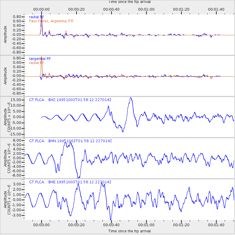
Earthquake location: Peru-Ecuador Border Region
Earthquake latitude/longitude: -2.8/-77.9
Earthquake time(UTC): 1995/10/03 (276) 01:51:24 GMT
Earthquake Depth: 27 km
Earthquake Magnitude: 6.5 MB, 7.0 MS, 6.9 UNKNOWN, 7.0 MW
Earthquake Catalog/Contributor: WHDF/NEIC
Network: GT Global Telemetered Seismograph Network (USAF/USGS)
Station: PLCA Paso Flores, Argentina
Lat/Lon: 40.73 S/70.55 W
Elevation: 1050 m
Distance: 38.4 deg
Az: 171.009 deg
Baz: 348.146 deg
Ray Param: 0.07555852
Estimated Moho Depth: 36.75 km
Estimated Crust Vp/Vs: 1.74
Assumed Crust Vp: 6.597 km/s
Estimated Crust Vs: 3.797 km/s
Estimated Crust Poisson's Ratio: 0.25
Radial Match: 85.42368 %
Radial Bump: 266
Transverse Match: 71.85317 %
Transverse Bump: 400
SOD ConfigId: 6273
Insert Time: 2010-02-27 02:13:21.189 +0000
GWidth: 2.5
Max Bumps: 400
Tol: 0.001

Signal To Noise

ChannelStoNSTALTA
GT:PLCA: :BHN:19951003T01:58:12.227014Z1.55969431.7124344E-61.0979295E-6
GT:PLCA: :BHE:19951003T01:58:12.227014Z1.50011771.0296551E-66.863829E-7
GT:PLCA: :BHZ:19951003T01:58:12.227014Z1.25634382.125519E-61.6918291E-6
Arrivals
Ps4.4 SECOND
PpPs14 SECOND
PsPs/PpSs19 SECOND