PLCA Paso Flores, Argentina - Earthquake Result Viewer
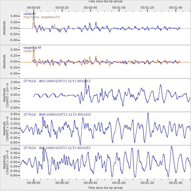
Earthquake location: South Of Kermadec Islands
Earthquake latitude/longitude: -32.9/-178.3
Earthquake time(UTC): 1996/01/30 (030) 22:00:12 GMT
Earthquake Depth: 33 km
Earthquake Magnitude: 5.5 MB, 6.2 MS, 6.3 UNKNOWN, 6.0 MW
Earthquake Catalog/Contributor: WHDF/NEIC
Network: GT Global Telemetered Seismograph Network (USAF/USGS)
Station: PLCA Paso Flores, Argentina
Lat/Lon: 40.73 S/70.55 W
Elevation: 1050 m
Distance: 81.0 deg
Az: 132.899 deg
Baz: 234.205 deg
Ray Param: 0.04782786
Estimated Moho Depth: 31.75 km
Estimated Crust Vp/Vs: 1.82
Assumed Crust Vp: 6.597 km/s
Estimated Crust Vs: 3.635 km/s
Estimated Crust Poisson's Ratio: 0.28
Radial Match: 84.19857 %
Radial Bump: 318
Transverse Match: 63.53027 %
Transverse Bump: 400
SOD ConfigId: 6273
Insert Time: 2010-02-27 02:13:46.809 +0000
GWidth: 2.5
Max Bumps: 400
Tol: 0.001

Signal To Noise

ChannelStoNSTALTA
GT:PLCA: :BHN:19960130T22:11:52.803015Z1.38301441.586057E-71.14681164E-7
GT:PLCA: :BHE:19960130T22:11:52.803015Z2.19429282.0359394E-79.2783395E-8
GT:PLCA: :BHZ:19960130T22:11:52.803015Z2.72641354.902564E-71.7981733E-7
Arrivals
Ps4.0 SECOND
PpPs13 SECOND
PsPs/PpSs17 SECOND