PLCA Paso Flores, Argentina - Earthquake Result Viewer
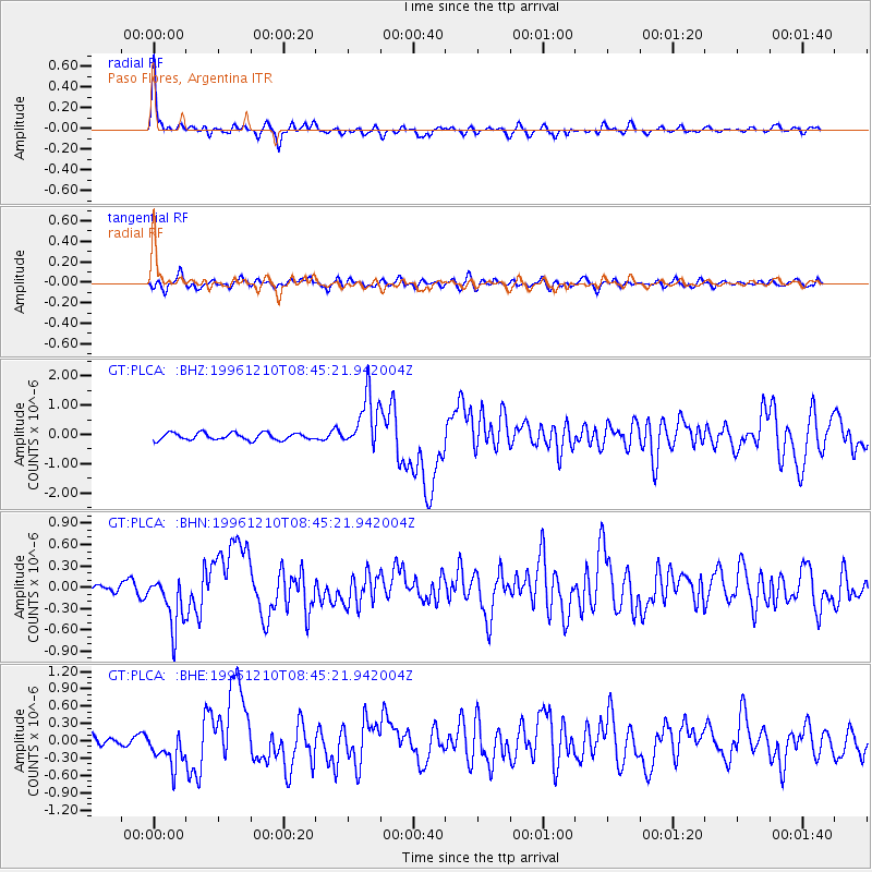
Earthquake location: Central Mid-Atlantic Ridge
Earthquake latitude/longitude: 0.9/-30.0
Earthquake time(UTC): 1996/12/10 (345) 08:36:18 GMT
Earthquake Depth: 10 km
Earthquake Magnitude: 6.0 MB, 6.2 MS, 6.6 UNKNOWN, 6.6 MW
Earthquake Catalog/Contributor: WHDF/NEIC
Network: GT Global Telemetered Seismograph Network (USAF/USGS)
Station: PLCA Paso Flores, Argentina
Lat/Lon: 40.73 S/70.55 W
Elevation: 1050 m
Distance: 55.4 deg
Az: 216.851 deg
Baz: 52.103 deg
Ray Param: 0.06481955
Estimated Moho Depth: 31.25 km
Estimated Crust Vp/Vs: 2.10
Assumed Crust Vp: 6.597 km/s
Estimated Crust Vs: 3.145 km/s
Estimated Crust Poisson's Ratio: 0.35
Radial Match: 90.51775 %
Radial Bump: 342
Transverse Match: 69.154976 %
Transverse Bump: 400
SOD ConfigId: 6273
Insert Time: 2010-02-27 02:13:49.786 +0000
GWidth: 2.5
Max Bumps: 400
Tol: 0.001

Signal To Noise

ChannelStoNSTALTA
GT:PLCA: :BHN:19961210T08:45:21.942004Z5.02562953.7127288E-77.38759E-8
GT:PLCA: :BHE:19961210T08:45:21.942004Z2.73679453.0787308E-71.1249404E-7
GT:PLCA: :BHZ:19961210T08:45:21.942004Z7.67811739.1405184E-71.19046355E-7
Arrivals
Ps5.4 SECOND
PpPs14 SECOND
PsPs/PpSs19 SECOND