GARM Garm, Tajikistan - Earthquake Result Viewer
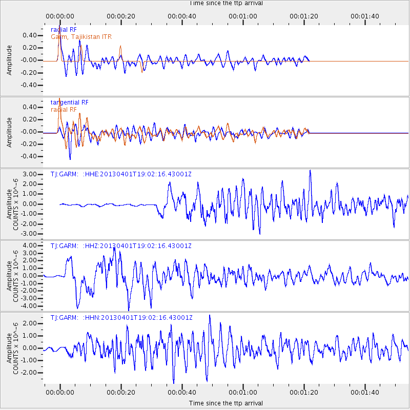
Earthquake location: Off East Coast Of Honshu, Japan
Earthquake latitude/longitude: 39.5/143.2
Earthquake time(UTC): 2013/04/01 (091) 18:53:17 GMT
Earthquake Depth: 14 km
Earthquake Magnitude: 6.0 MW, 5.6 MB, 5.7 MS, 6.0 MW
Earthquake Catalog/Contributor: NEIC PDE/NEIC PDE-W
Network: TJ Tajikistan National Seismic Network
Station: GARM Garm, Tajikistan
Lat/Lon: 39.00 N/70.32 E
Elevation: 1305 m
Distance: 54.9 deg
Az: 294.487 deg
Baz: 64.596 deg
Ray Param: 0.0651406
Estimated Moho Depth: 20.0 km
Estimated Crust Vp/Vs: 1.98
Assumed Crust Vp: 6.306 km/s
Estimated Crust Vs: 3.185 km/s
Estimated Crust Poisson's Ratio: 0.33
Radial Match: 88.610794 %
Radial Bump: 400
Transverse Match: 83.96966 %
Transverse Bump: 400
SOD ConfigId: 510825
Insert Time: 2013-09-04 22:24:01.296 +0000
GWidth: 2.5
Max Bumps: 400
Tol: 0.001

Signal To Noise

ChannelStoNSTALTA
TJ:GARM: :HHZ:20130401T19:02:16.43001Z8.8264421.3496053E-61.5290479E-7
TJ:GARM: :HHN:20130401T19:02:16.43001Z4.77234363.0606594E-76.413326E-8
TJ:GARM: :HHE:20130401T19:02:16.43001Z7.37429865.9089103E-78.012844E-8
Arrivals
Ps3.3 SECOND
PpPs9.0 SECOND
PsPs/PpSs12 SECOND