You are here: Home > Network List > GS - US Geological Survey Networks Stations List
> Station KAN13 Rinehart Farm > Earthquake Result Viewer
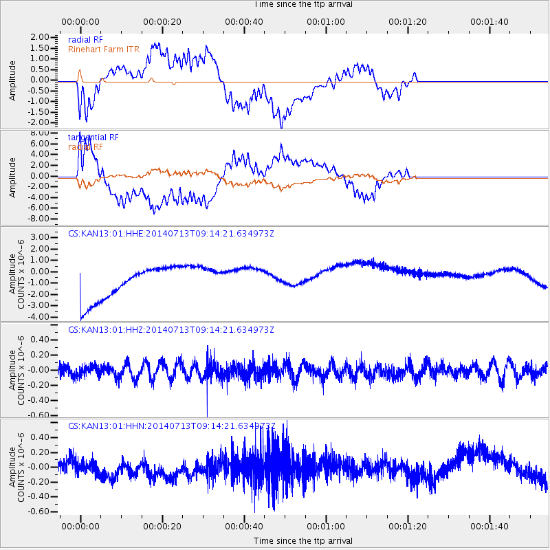
KAN13 Rinehart Farm - Earthquake Result Viewer
*The percent match for this event was below the threshold and hence no stack was calculated.
| Earthquake location: |
Laptev Sea |
| Earthquake latitude/longitude: |
77.3/125.7 |
| Earthquake time(UTC): |
2014/07/13 (194) 09:04:24 GMT |
| Earthquake Depth: |
0.0 km |
| Earthquake Magnitude: |
3.5 mb, 3.7 mb1, 3.4 mb1mx, 3.5 mbtmp, 6.1 ML |
| Earthquake Catalog/Contributor: |
ISC/ISC |
|
| Network: |
GS US Geological Survey Networks |
| Station: |
KAN13 Rinehart Farm |
| Lat/Lon: |
37.01 N/97.48 W |
| Elevation: |
340 m |
|
| Distance: |
62.9 deg |
| Az: |
37.934 deg |
| Baz: |
350.221 deg |
| Ray Param: |
$rayparam |
*The percent match for this event was below the threshold and hence was not used in the summary stack. |
|
| Radial Match: |
60.10855 % |
| Radial Bump: |
400 |
| Transverse Match: |
63.805622 % |
| Transverse Bump: |
400 |
| SOD ConfigId: |
3390531 |
| Insert Time: |
2019-04-12 20:08:04.536 +0000 |
| GWidth: |
2.5 |
| Max Bumps: |
400 |
| Tol: |
0.001 |
|
Signal To Noise
| Channel | StoN | STA | LTA |
| GS:KAN13:01:HHZ:20140713T09:14:21.634973Z | 0.9108883 | 6.459654E-8 | 7.091598E-8 |
| GS:KAN13:01:HHN:20140713T09:14:21.634973Z | 0.6424234 | 1.5073977E-7 | 2.346424E-7 |
| GS:KAN13:01:HHE:20140713T09:14:21.634973Z | 0.87112284 | 1.2600904E-6 | 1.4465129E-6 |
| Arrivals |
| Ps | |
| PpPs | |
| PsPs/PpSs | |


