You are here: Home > Network List > TA - USArray Transportable Network (new EarthScope stations) Stations List
> Station G59A Clarenceville, QC, USA > Earthquake Result Viewer
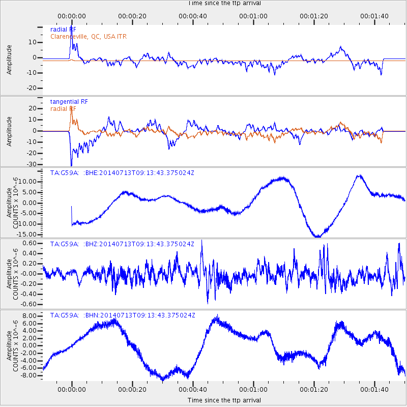
G59A Clarenceville, QC, USA - Earthquake Result Viewer
*The percent match for this event was below the threshold and hence no stack was calculated.
| Earthquake location: |
Laptev Sea |
| Earthquake latitude/longitude: |
77.3/125.7 |
| Earthquake time(UTC): |
2014/07/13 (194) 09:04:24 GMT |
| Earthquake Depth: |
0.0 km |
| Earthquake Magnitude: |
3.5 mb, 3.7 mb1, 3.4 mb1mx, 3.5 mbtmp, 6.1 ML |
| Earthquake Catalog/Contributor: |
ISC/ISC |
|
| Network: |
TA USArray Transportable Network (new EarthScope stations) |
| Station: |
G59A Clarenceville, QC, USA |
| Lat/Lon: |
45.08 N/73.18 W |
| Elevation: |
36 m |
|
| Distance: |
57.3 deg |
| Az: |
15.774 deg |
| Baz: |
355.133 deg |
| Ray Param: |
$rayparam |
*The percent match for this event was below the threshold and hence was not used in the summary stack. |
|
| Radial Match: |
64.14332 % |
| Radial Bump: |
400 |
| Transverse Match: |
82.55409 % |
| Transverse Bump: |
390 |
| SOD ConfigId: |
3390531 |
| Insert Time: |
2019-04-12 20:11:12.119 +0000 |
| GWidth: |
2.5 |
| Max Bumps: |
400 |
| Tol: |
0.001 |
|
Signal To Noise
| Channel | StoN | STA | LTA |
| TA:G59A: :BHZ:20140713T09:13:43.375024Z | 0.92483735 | 8.7162334E-8 | 9.424612E-8 |
| TA:G59A: :BHN:20140713T09:13:43.375024Z | 0.16566172 | 1.4709065E-6 | 8.878977E-6 |
| TA:G59A: :BHE:20140713T09:13:43.375024Z | 0.93398607 | 5.2626915E-6 | 5.6346576E-6 |
| Arrivals |
| Ps | |
| PpPs | |
| PsPs/PpSs | |


