PLCA Paso Flores, Argentina - Earthquake Result Viewer
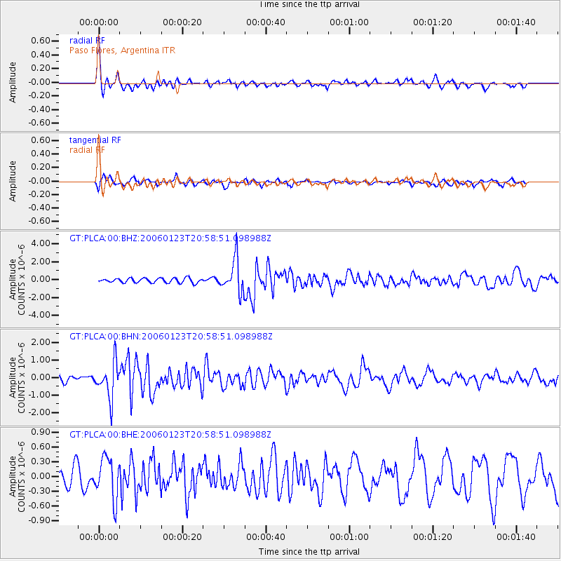
Earthquake location: Near West Coast Of Colombia
Earthquake latitude/longitude: 6.9/-77.8
Earthquake time(UTC): 2006/01/23 (023) 20:50:44 GMT
Earthquake Depth: 14 km
Earthquake Magnitude: 6.1 MB, 5.9 MS, 6.2 MW, 6.1 MW
Earthquake Catalog/Contributor: WHDF/NEIC
Network: GT Global Telemetered Seismograph Network (USAF/USGS)
Station: PLCA Paso Flores, Argentina
Lat/Lon: 40.73 S/70.55 W
Elevation: 1050 m
Distance: 47.8 deg
Az: 172.573 deg
Baz: 350.277 deg
Ray Param: 0.06973308
Estimated Moho Depth: 10.0 km
Estimated Crust Vp/Vs: 2.10
Assumed Crust Vp: 6.597 km/s
Estimated Crust Vs: 3.145 km/s
Estimated Crust Poisson's Ratio: 0.35
Radial Match: 80.352234 %
Radial Bump: 374
Transverse Match: 62.197037 %
Transverse Bump: 400
SOD ConfigId: 4977
Insert Time: 2010-02-27 02:14:46.073 +0000
GWidth: 2.5
Max Bumps: 400
Tol: 0.001

Signal To Noise

ChannelStoNSTALTA
GT:PLCA:00:BHN:20060123T20:58:51.098988Z4.5899711.0450611E-62.276836E-7
GT:PLCA:00:BHE:20060123T20:58:51.098988Z2.27100184.3377267E-71.9100497E-7
GT:PLCA:00:BHZ:20060123T20:58:51.098988Z7.5714831.9053458E-62.5164763E-7
Arrivals
Ps1.8 SECOND
PpPs4.4 SECOND
PsPs/PpSs6.2 SECOND