You are here: Home > Network List > TA - USArray Transportable Network (new EarthScope stations) Stations List
> Station R54A Victor, WV, USA > Earthquake Result Viewer
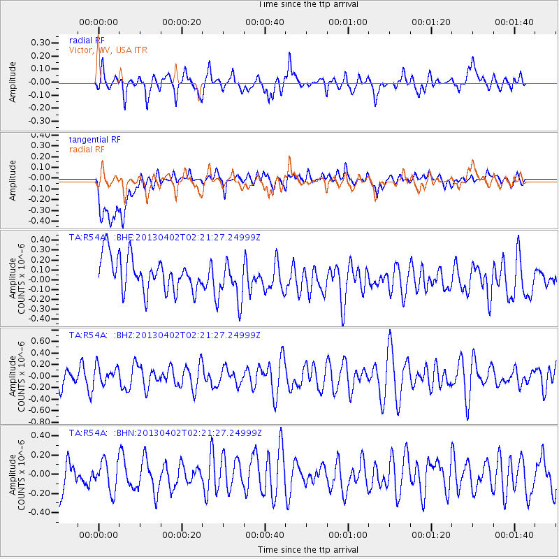
R54A Victor, WV, USA - Earthquake Result Viewer
*The percent match for this event was below the threshold and hence no stack was calculated.
| Earthquake location: |
Off East Coast Of Honshu, Japan |
| Earthquake latitude/longitude: |
39.5/143.2 |
| Earthquake time(UTC): |
2013/04/02 (092) 02:08:47 GMT |
| Earthquake Depth: |
17 km |
| Earthquake Magnitude: |
5.5 MW, 5.5 MW |
| Earthquake Catalog/Contributor: |
NEIC PDE/NEIC PDE-W |
|
| Network: |
TA USArray Transportable Network (new EarthScope stations) |
| Station: |
R54A Victor, WV, USA |
| Lat/Lon: |
38.18 N/80.99 W |
| Elevation: |
512 m |
|
| Distance: |
92.7 deg |
| Az: |
33.333 deg |
| Baz: |
327.354 deg |
| Ray Param: |
$rayparam |
*The percent match for this event was below the threshold and hence was not used in the summary stack. |
|
| Radial Match: |
62.063614 % |
| Radial Bump: |
400 |
| Transverse Match: |
56.46919 % |
| Transverse Bump: |
400 |
| SOD ConfigId: |
511491 |
| Insert Time: |
2013-09-05 01:40:06.488 +0000 |
| GWidth: |
2.5 |
| Max Bumps: |
400 |
| Tol: |
0.001 |
|
Signal To Noise
| Channel | StoN | STA | LTA |
| TA:R54A: :BHZ:20130402T02:21:27.24999Z | 0.6215573 | 1.5382366E-7 | 2.4748107E-7 |
| TA:R54A: :BHN:20130402T02:21:27.24999Z | 0.9664976 | 1.6302141E-7 | 1.6867234E-7 |
| TA:R54A: :BHE:20130402T02:21:27.24999Z | 1.1602707 | 2.008794E-7 | 1.731315E-7 |
| Arrivals |
| Ps | |
| PpPs | |
| PsPs/PpSs | |


