You are here: Home > Network List > TA - USArray Transportable Network (new EarthScope stations) Stations List
> Station U41A Viola, AR, USA > Earthquake Result Viewer
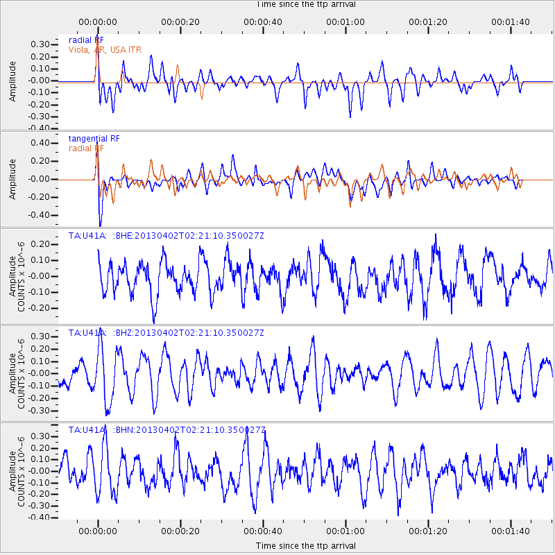
U41A Viola, AR, USA - Earthquake Result Viewer
*The percent match for this event was below the threshold and hence no stack was calculated.
| Earthquake location: |
Off East Coast Of Honshu, Japan |
| Earthquake latitude/longitude: |
39.5/143.2 |
| Earthquake time(UTC): |
2013/04/02 (092) 02:08:47 GMT |
| Earthquake Depth: |
17 km |
| Earthquake Magnitude: |
5.5 MW, 5.5 MW |
| Earthquake Catalog/Contributor: |
NEIC PDE/NEIC PDE-W |
|
| Network: |
TA USArray Transportable Network (new EarthScope stations) |
| Station: |
U41A Viola, AR, USA |
| Lat/Lon: |
36.34 N/91.92 W |
| Elevation: |
300 m |
|
| Distance: |
89.1 deg |
| Az: |
41.457 deg |
| Baz: |
320.624 deg |
| Ray Param: |
$rayparam |
*The percent match for this event was below the threshold and hence was not used in the summary stack. |
|
| Radial Match: |
43.189064 % |
| Radial Bump: |
400 |
| Transverse Match: |
61.079075 % |
| Transverse Bump: |
400 |
| SOD ConfigId: |
511491 |
| Insert Time: |
2013-09-05 01:40:53.646 +0000 |
| GWidth: |
2.5 |
| Max Bumps: |
400 |
| Tol: |
0.001 |
|
Signal To Noise
| Channel | StoN | STA | LTA |
| TA:U41A: :BHZ:20130402T02:21:10.350027Z | 2.1075919 | 2.2727748E-7 | 1.07837515E-7 |
| TA:U41A: :BHN:20130402T02:21:10.350027Z | 1.9244163 | 2.115578E-7 | 1.09933495E-7 |
| TA:U41A: :BHE:20130402T02:21:10.350027Z | 0.9391569 | 8.848121E-8 | 9.421345E-8 |
| Arrivals |
| Ps | |
| PpPs | |
| PsPs/PpSs | |


