You are here: Home > Network List > TA - USArray Transportable Network (new EarthScope stations) Stations List
> Station V47A Nunnelly, TN, USA > Earthquake Result Viewer
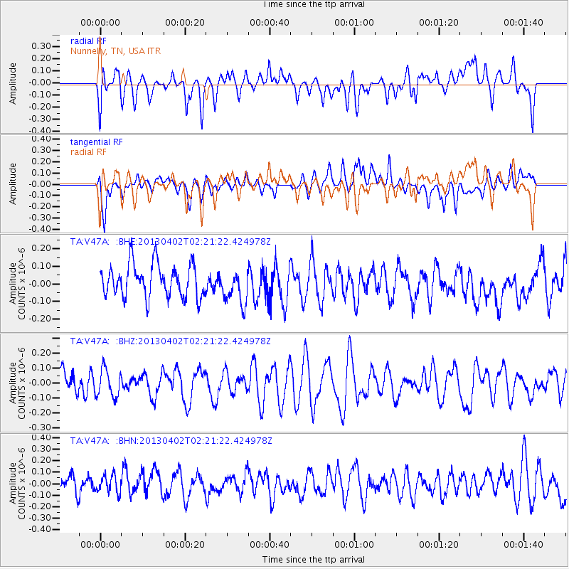
V47A Nunnelly, TN, USA - Earthquake Result Viewer
*The percent match for this event was below the threshold and hence no stack was calculated.
| Earthquake location: |
Off East Coast Of Honshu, Japan |
| Earthquake latitude/longitude: |
39.5/143.2 |
| Earthquake time(UTC): |
2013/04/02 (092) 02:08:47 GMT |
| Earthquake Depth: |
17 km |
| Earthquake Magnitude: |
5.5 MW, 5.5 MW |
| Earthquake Catalog/Contributor: |
NEIC PDE/NEIC PDE-W |
|
| Network: |
TA USArray Transportable Network (new EarthScope stations) |
| Station: |
V47A Nunnelly, TN, USA |
| Lat/Lon: |
35.83 N/87.52 W |
| Elevation: |
240 m |
|
| Distance: |
91.7 deg |
| Az: |
38.969 deg |
| Baz: |
323.221 deg |
| Ray Param: |
$rayparam |
*The percent match for this event was below the threshold and hence was not used in the summary stack. |
|
| Radial Match: |
57.517326 % |
| Radial Bump: |
400 |
| Transverse Match: |
56.24292 % |
| Transverse Bump: |
400 |
| SOD ConfigId: |
511491 |
| Insert Time: |
2013-09-05 01:41:13.379 +0000 |
| GWidth: |
2.5 |
| Max Bumps: |
400 |
| Tol: |
0.001 |
|
Signal To Noise
| Channel | StoN | STA | LTA |
| TA:V47A: :BHZ:20130402T02:21:22.424978Z | 0.9492379 | 9.255457E-8 | 9.7504085E-8 |
| TA:V47A: :BHN:20130402T02:21:22.424978Z | 0.74527365 | 7.604256E-8 | 1.0203308E-7 |
| TA:V47A: :BHE:20130402T02:21:22.424978Z | 1.117822 | 1.0405193E-7 | 9.3084516E-8 |
| Arrivals |
| Ps | |
| PpPs | |
| PsPs/PpSs | |


