PLCA Paso Flores, Argentina - Earthquake Result Viewer
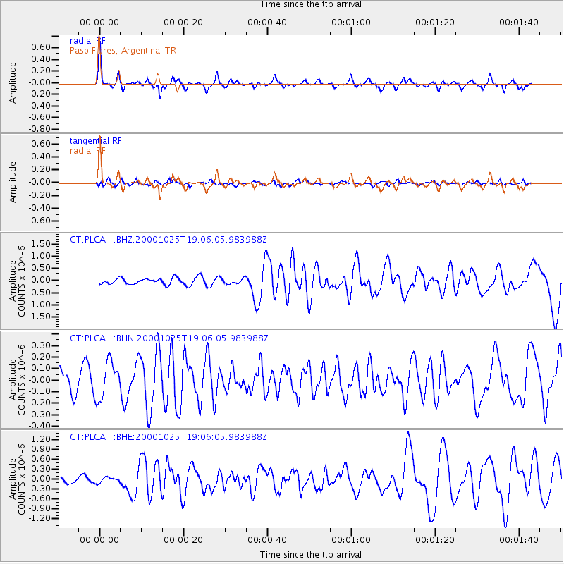
Earthquake location: Southern East Pacific Rise
Earthquake latitude/longitude: -34.7/-109.5
Earthquake time(UTC): 2000/10/25 (299) 19:00:17 GMT
Earthquake Depth: 10 km
Earthquake Magnitude: 5.6 MB, 5.7 MS, 6.1 MW, 6.1 MW
Earthquake Catalog/Contributor: WHDF/NEIC
Network: GT Global Telemetered Seismograph Network (USAF/USGS)
Station: PLCA Paso Flores, Argentina
Lat/Lon: 40.73 S/70.55 W
Elevation: 1050 m
Distance: 31.2 deg
Az: 112.815 deg
Baz: 268.502 deg
Ray Param: 0.07913606
Estimated Moho Depth: 64.5 km
Estimated Crust Vp/Vs: 2.09
Assumed Crust Vp: 6.597 km/s
Estimated Crust Vs: 3.153 km/s
Estimated Crust Poisson's Ratio: 0.35
Radial Match: 80.57925 %
Radial Bump: 348
Transverse Match: 57.204964 %
Transverse Bump: 400
SOD ConfigId: 3744
Insert Time: 2010-02-27 02:14:55.219 +0000
GWidth: 2.5
Max Bumps: 400
Tol: 0.001

Signal To Noise

ChannelStoNSTALTA
GT:PLCA: :BHN:20001025T19:06:05.983988Z1.57575611.600012E-71.0153933E-7
GT:PLCA: :BHE:20001025T19:06:05.983988Z0.68626858.300889E-81.2095688E-7
GT:PLCA: :BHZ:20001025T19:06:05.983988Z0.75280491.0540991E-71.4002288E-7
Arrivals
Ps11 SECOND
PpPs28 SECOND
PsPs/PpSs40 SECOND