PLCA Paso Flores, Argentina - Earthquake Result Viewer
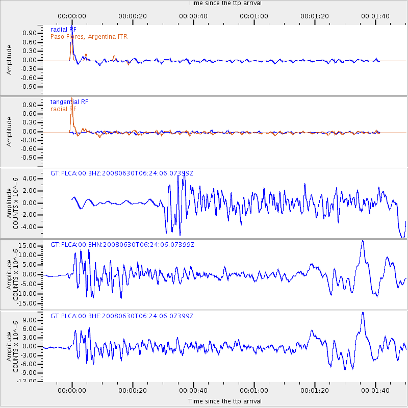
Earthquake location: South Sandwich Islands Region
Earthquake latitude/longitude: -58.2/-22.1
Earthquake time(UTC): 2008/06/30 (182) 06:17:44 GMT
Earthquake Depth: 19 km
Earthquake Magnitude: 6.1 MB, 6.7 MS, 7.0 MW, 6.9 MW
Earthquake Catalog/Contributor: WHDF/NEIC
Network: GT Global Telemetered Seismograph Network (USAF/USGS)
Station: PLCA Paso Flores, Argentina
Lat/Lon: 40.73 S/70.55 W
Elevation: 1050 m
Distance: 35.1 deg
Az: 278.369 deg
Baz: 136.45 deg
Ray Param: 0.07738435
Estimated Moho Depth: 38.5 km
Estimated Crust Vp/Vs: 1.71
Assumed Crust Vp: 6.597 km/s
Estimated Crust Vs: 3.853 km/s
Estimated Crust Poisson's Ratio: 0.24
Radial Match: 92.51126 %
Radial Bump: 400
Transverse Match: 62.7907 %
Transverse Bump: 400
SOD ConfigId: 2504
Insert Time: 2010-02-27 02:15:44.489 +0000
GWidth: 2.5
Max Bumps: 400
Tol: 0.001

Signal To Noise

ChannelStoNSTALTA
GT:PLCA:00:BHN:20080630T06:24:06.07399Z15.357936.3214916E-64.116109E-7
GT:PLCA:00:BHE:20080630T06:24:06.07399Z12.9239833.1169009E-62.4117185E-7
GT:PLCA:00:BHZ:20080630T06:24:06.07399Z7.88364552.74653E-63.4838325E-7
Arrivals
Ps4.5 SECOND
PpPs15 SECOND
PsPs/PpSs19 SECOND