PLCA Paso Flores, Argentina - Earthquake Result Viewer
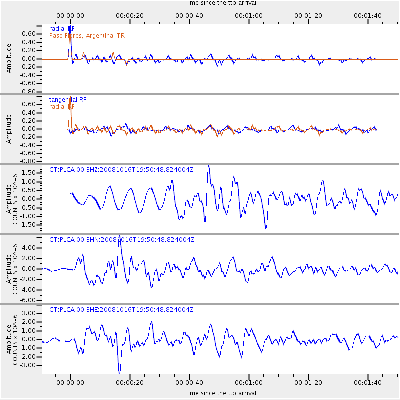
Earthquake location: Near Coast Of Chiapas, Mexico
Earthquake latitude/longitude: 14.4/-92.4
Earthquake time(UTC): 2008/10/16 (290) 19:41:25 GMT
Earthquake Depth: 24 km
Earthquake Magnitude: 6.1 MB, 6.6 MS, 6.7 MW, 6.6 MW
Earthquake Catalog/Contributor: WHDF/NEIC
Network: GT Global Telemetered Seismograph Network (USAF/USGS)
Station: PLCA Paso Flores, Argentina
Lat/Lon: 40.73 S/70.55 W
Elevation: 1050 m
Distance: 58.5 deg
Az: 160.657 deg
Baz: 335.021 deg
Ray Param: 0.06277809
Estimated Moho Depth: 10.25 km
Estimated Crust Vp/Vs: 2.09
Assumed Crust Vp: 6.597 km/s
Estimated Crust Vs: 3.157 km/s
Estimated Crust Poisson's Ratio: 0.35
Radial Match: 91.39866 %
Radial Bump: 351
Transverse Match: 69.20898 %
Transverse Bump: 368
SOD ConfigId: 2556
Insert Time: 2010-02-27 02:15:46.412 +0000
GWidth: 2.5
Max Bumps: 400
Tol: 0.001

Signal To Noise

ChannelStoNSTALTA
GT:PLCA:00:BHN:20081016T19:50:48.824004Z5.01768161.3248005E-62.640264E-7
GT:PLCA:00:BHE:20081016T19:50:48.824004Z3.83805277.9412155E-72.069074E-7
GT:PLCA:00:BHZ:20081016T19:50:48.824004Z1.54797476.1945565E-74.0017167E-7
Arrivals
Ps1.8 SECOND
PpPs4.6 SECOND
PsPs/PpSs6.4 SECOND