You are here: Home > Network List > CN - Canadian National Seismograph Network Stations List
> Station INK INUVIK, NT > Earthquake Result Viewer
INK INUVIK, NT - Earthquake Result Viewer
*The percent match for this event was below the threshold and hence no stack was calculated.
| Earthquake location: |
Myanmar |
| Earthquake latitude/longitude: |
19.2/95.6 |
| Earthquake time(UTC): |
2013/04/03 (093) 16:35:45 GMT |
| Earthquake Depth: |
6.0 km |
| Earthquake Magnitude: |
5.8 MB |
| Earthquake Catalog/Contributor: |
NEIC PDE/NEIC PDE-W |
|
| Network: |
CN Canadian National Seismograph Network |
| Station: |
INK INUVIK, NT |
| Lat/Lon: |
68.31 N/133.53 W |
| Elevation: |
44 m |
|
| Distance: |
85.7 deg |
| Az: |
16.385 deg |
| Baz: |
314.195 deg |
| Ray Param: |
$rayparam |
*The percent match for this event was below the threshold and hence was not used in the summary stack. |
|
| Radial Match: |
46.98382 % |
| Radial Bump: |
400 |
| Transverse Match: |
63.348434 % |
| Transverse Bump: |
400 |
| SOD ConfigId: |
511491 |
| Insert Time: |
2013-09-05 02:16:02.292 +0000 |
| GWidth: |
2.5 |
| Max Bumps: |
400 |
| Tol: |
0.001 |
|
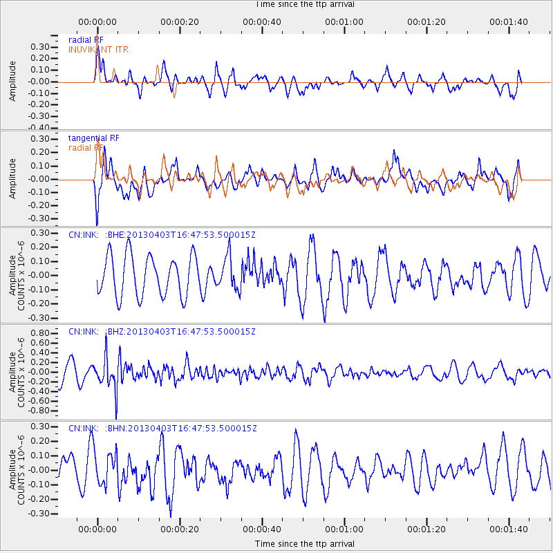
Signal To Noise
| Channel | StoN | STA | LTA |
| CN:INK: :BHZ:20130403T16:47:53.500015Z | 2.0041056 | 3.3620017E-7 | 1.6775572E-7 |
| CN:INK: :BHN:20130403T16:47:53.500015Z | 0.807199 | 1.13629376E-7 | 1.4076996E-7 |
| CN:INK: :BHE:20130403T16:47:53.500015Z | 0.8319182 | 1.1797902E-7 | 1.4181565E-7 |
| Arrivals |
| Ps | |
| PpPs | |
| PsPs/PpSs | |


