You are here: Home > Network List > GT - Global Telemetered Seismograph Network (USAF/USGS) Stations List
> Station PLCA Paso Flores, Argentina > Earthquake Result Viewer
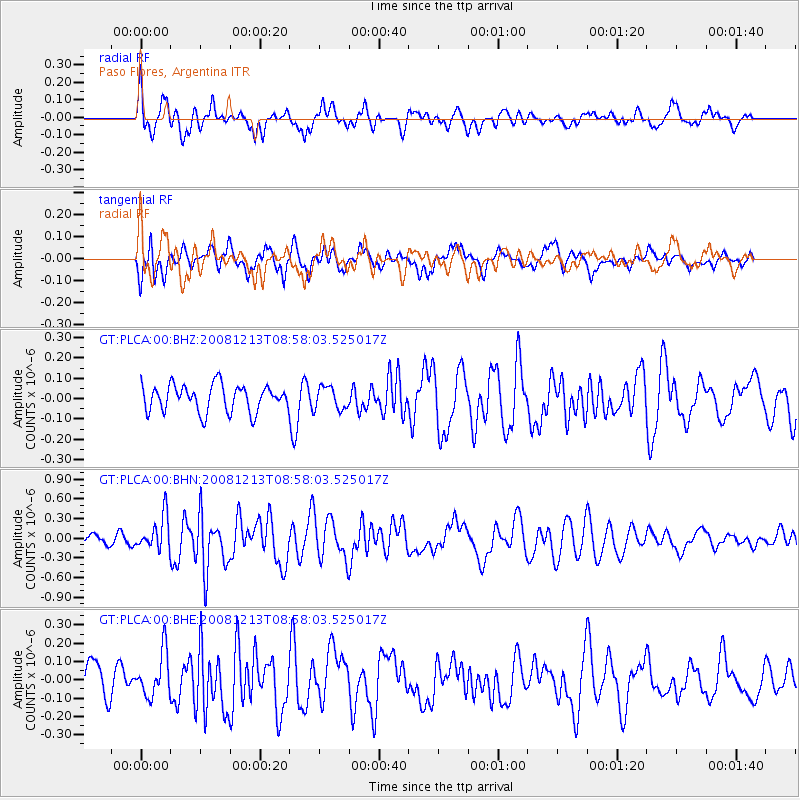
PLCA Paso Flores, Argentina - Earthquake Result Viewer
*The percent match for this event was below the threshold and hence no stack was calculated.
| Earthquake location: |
Western Indian-Antarctic Ridge |
| Earthquake latitude/longitude: |
-49.0/123.4 |
| Earthquake time(UTC): |
2008/12/13 (348) 08:45:36 GMT |
| Earthquake Depth: |
10 km |
| Earthquake Magnitude: |
6.0 MB, 5.8 MS, 5.9 MW, 5.9 MW |
| Earthquake Catalog/Contributor: |
WHDF/NEIC |
|
| Network: |
GT Global Telemetered Seismograph Network (USAF/USGS) |
| Station: |
PLCA Paso Flores, Argentina |
| Lat/Lon: |
40.73 S/70.55 W |
| Elevation: |
1050 m |
|
| Distance: |
89.8 deg |
| Az: |
169.445 deg |
| Baz: |
189.138 deg |
| Ray Param: |
$rayparam |
*The percent match for this event was below the threshold and hence was not used in the summary stack. |
|
| Radial Match: |
77.940315 % |
| Radial Bump: |
400 |
| Transverse Match: |
61.474697 % |
| Transverse Bump: |
400 |
| SOD ConfigId: |
2658 |
| Insert Time: |
2010-02-27 02:16:15.951 +0000 |
| GWidth: |
2.5 |
| Max Bumps: |
400 |
| Tol: |
0.001 |
|
Signal To Noise
| Channel | StoN | STA | LTA |
| GT:PLCA:00:BHN:20081213T08:58:03.525017Z | 2.5070894 | 2.6007385E-7 | 1.0373537E-7 |
| GT:PLCA:00:BHE:20081213T08:58:03.525017Z | 1.2276757 | 1.2069623E-7 | 9.8312796E-8 |
| GT:PLCA:00:BHZ:20081213T08:58:03.525017Z | 0.8599908 | 5.6117237E-8 | 6.52533E-8 |
| Arrivals |
| Ps | |
| PpPs | |
| PsPs/PpSs | |


