You are here: Home > Network List > GT - Global Telemetered Seismograph Network (USAF/USGS) Stations List
> Station PLCA Paso Flores, Argentina > Earthquake Result Viewer
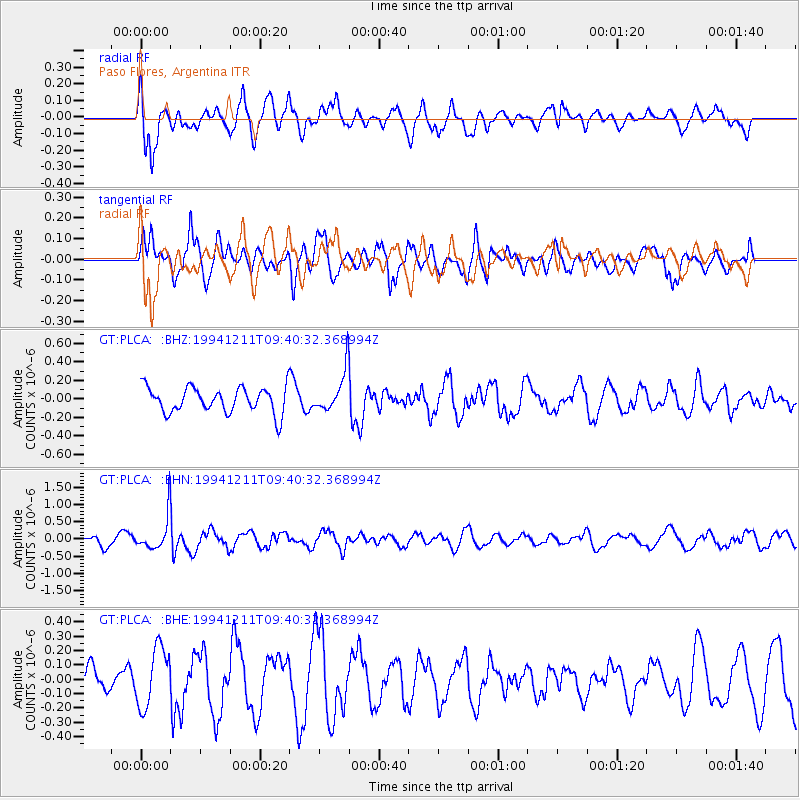
PLCA Paso Flores, Argentina - Earthquake Result Viewer
*The percent match for this event was below the threshold and hence no stack was calculated.
| Earthquake location: |
South Of Fiji Islands |
| Earthquake latitude/longitude: |
-24.9/-179.1 |
| Earthquake time(UTC): |
1994/12/11 (345) 09:29:01 GMT |
| Earthquake Depth: |
391 km |
| Earthquake Magnitude: |
5.5 MB, 5.6 UNKNOWN |
| Earthquake Catalog/Contributor: |
WHDF/NEIC |
|
| Network: |
GT Global Telemetered Seismograph Network (USAF/USGS) |
| Station: |
PLCA Paso Flores, Argentina |
| Lat/Lon: |
40.73 S/70.55 W |
| Elevation: |
1050 m |
|
| Distance: |
87.0 deg |
| Az: |
133.834 deg |
| Baz: |
239.551 deg |
| Ray Param: |
$rayparam |
*The percent match for this event was below the threshold and hence was not used in the summary stack. |
|
| Radial Match: |
73.06135 % |
| Radial Bump: |
400 |
| Transverse Match: |
76.362015 % |
| Transverse Bump: |
400 |
| SOD ConfigId: |
4480 |
| Insert Time: |
2010-02-27 02:16:17.575 +0000 |
| GWidth: |
2.5 |
| Max Bumps: |
400 |
| Tol: |
0.001 |
|
Signal To Noise
| Channel | StoN | STA | LTA |
| GT:PLCA: :BHN:19941211T09:40:32.368994Z | 3.6094532 | 5.151346E-7 | 1.4271819E-7 |
| GT:PLCA: :BHE:19941211T09:40:32.368994Z | 1.5916083 | 2.0776218E-7 | 1.3053601E-7 |
| GT:PLCA: :BHZ:19941211T09:40:32.368994Z | 1.5998607 | 2.1951818E-7 | 1.3721082E-7 |
| Arrivals |
| Ps | |
| PpPs | |
| PsPs/PpSs | |


