You are here: Home > Network List > GT - Global Telemetered Seismograph Network (USAF/USGS) Stations List
> Station PLCA Paso Flores, Argentina > Earthquake Result Viewer
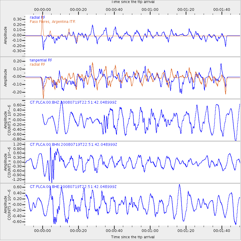
PLCA Paso Flores, Argentina - Earthquake Result Viewer
*The percent match for this event was below the threshold and hence no stack was calculated.
| Earthquake location: |
Fiji Islands Region |
| Earthquake latitude/longitude: |
-17.3/-177.3 |
| Earthquake time(UTC): |
2008/07/19 (201) 22:39:52 GMT |
| Earthquake Depth: |
391 km |
| Earthquake Magnitude: |
5.9 MB, 6.4 MW, 6.4 MW |
| Earthquake Catalog/Contributor: |
WHDF/NEIC |
|
| Network: |
GT Global Telemetered Seismograph Network (USAF/USGS) |
| Station: |
PLCA Paso Flores, Argentina |
| Lat/Lon: |
40.73 S/70.55 W |
| Elevation: |
1050 m |
|
| Distance: |
91.0 deg |
| Az: |
133.303 deg |
| Baz: |
246.161 deg |
| Ray Param: |
$rayparam |
*The percent match for this event was below the threshold and hence was not used in the summary stack. |
|
| Radial Match: |
40.187325 % |
| Radial Bump: |
400 |
| Transverse Match: |
64.11939 % |
| Transverse Bump: |
400 |
| SOD ConfigId: |
2504 |
| Insert Time: |
2010-02-27 02:17:22.802 +0000 |
| GWidth: |
2.5 |
| Max Bumps: |
400 |
| Tol: |
0.001 |
|
Signal To Noise
| Channel | StoN | STA | LTA |
| GT:PLCA:00:BHN:20080719T22:51:42.048999Z | 2.2837365 | 6.466902E-7 | 2.8317197E-7 |
| GT:PLCA:00:BHE:20080719T22:51:42.048999Z | 1.2322754 | 2.8747067E-7 | 2.3328445E-7 |
| GT:PLCA:00:BHZ:20080719T22:51:42.048999Z | 0.6581655 | 1.9132031E-7 | 2.9068724E-7 |
| Arrivals |
| Ps | |
| PpPs | |
| PsPs/PpSs | |


