You are here: Home > Network List > GT - Global Telemetered Seismograph Network (USAF/USGS) Stations List
> Station PLCA Paso Flores, Argentina > Earthquake Result Viewer
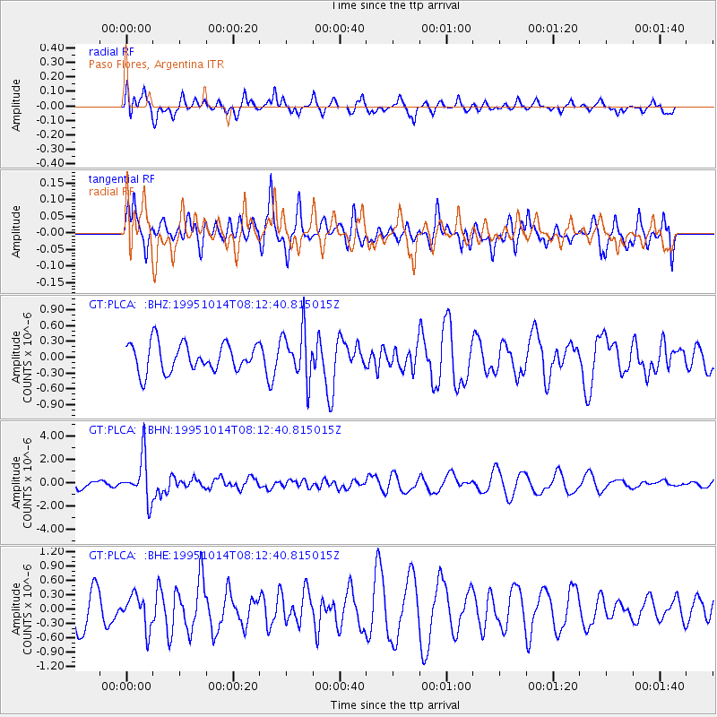
PLCA Paso Flores, Argentina - Earthquake Result Viewer
*The percent match for this event was below the threshold and hence no stack was calculated.
| Earthquake location: |
South Of Fiji Islands |
| Earthquake latitude/longitude: |
-25.6/-177.5 |
| Earthquake time(UTC): |
1995/10/14 (287) 08:00:41 GMT |
| Earthquake Depth: |
70 km |
| Earthquake Magnitude: |
5.9 MB, 6.2 UNKNOWN, 6.2 MW |
| Earthquake Catalog/Contributor: |
WHDF/NEIC |
|
| Network: |
GT Global Telemetered Seismograph Network (USAF/USGS) |
| Station: |
PLCA Paso Flores, Argentina |
| Lat/Lon: |
40.73 S/70.55 W |
| Elevation: |
1050 m |
|
| Distance: |
85.5 deg |
| Az: |
133.185 deg |
| Baz: |
240.069 deg |
| Ray Param: |
$rayparam |
*The percent match for this event was below the threshold and hence was not used in the summary stack. |
|
| Radial Match: |
37.576515 % |
| Radial Bump: |
396 |
| Transverse Match: |
43.228237 % |
| Transverse Bump: |
367 |
| SOD ConfigId: |
4480 |
| Insert Time: |
2010-02-27 02:17:36.055 +0000 |
| GWidth: |
2.5 |
| Max Bumps: |
400 |
| Tol: |
0.001 |
|
Signal To Noise
| Channel | StoN | STA | LTA |
| GT:PLCA: :BHN:19951014T08:12:40.815015Z | 4.130044 | 1.8960884E-6 | 4.590964E-7 |
| GT:PLCA: :BHE:19951014T08:12:40.815015Z | 0.78657687 | 3.4769246E-7 | 4.4203242E-7 |
| GT:PLCA: :BHZ:19951014T08:12:40.815015Z | 1.7587023 | 4.6976206E-7 | 2.6710723E-7 |
| Arrivals |
| Ps | |
| PpPs | |
| PsPs/PpSs | |


