You are here: Home > Network List > GT - Global Telemetered Seismograph Network (USAF/USGS) Stations List
> Station PLCA Paso Flores, Argentina > Earthquake Result Viewer
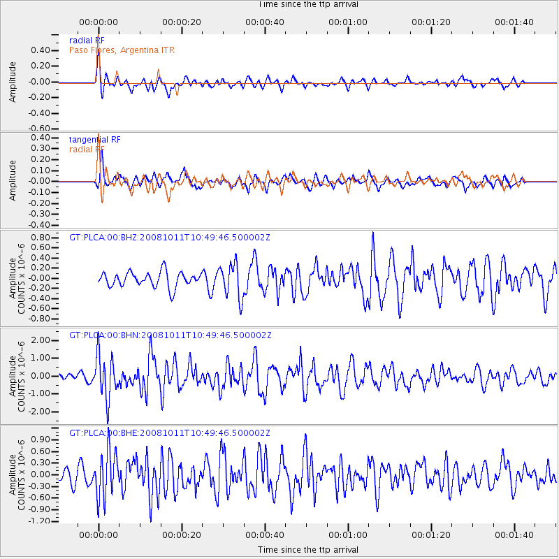
PLCA Paso Flores, Argentina - Earthquake Result Viewer
*The percent match for this event was below the threshold and hence no stack was calculated.
| Earthquake location: |
Virgin Islands |
| Earthquake latitude/longitude: |
19.2/-64.8 |
| Earthquake time(UTC): |
2008/10/11 (285) 10:40:14 GMT |
| Earthquake Depth: |
23 km |
| Earthquake Magnitude: |
6.1 MB, 5.9 MS, 6.1 MW, 6.0 MW |
| Earthquake Catalog/Contributor: |
WHDF/NEIC |
|
| Network: |
GT Global Telemetered Seismograph Network (USAF/USGS) |
| Station: |
PLCA Paso Flores, Argentina |
| Lat/Lon: |
40.73 S/70.55 W |
| Elevation: |
1050 m |
|
| Distance: |
59.8 deg |
| Az: |
185.024 deg |
| Baz: |
6.254 deg |
| Ray Param: |
$rayparam |
*The percent match for this event was below the threshold and hence was not used in the summary stack. |
|
| Radial Match: |
66.430855 % |
| Radial Bump: |
400 |
| Transverse Match: |
68.55628 % |
| Transverse Bump: |
400 |
| SOD ConfigId: |
2556 |
| Insert Time: |
2010-02-27 02:17:37.097 +0000 |
| GWidth: |
2.5 |
| Max Bumps: |
400 |
| Tol: |
0.001 |
|
Signal To Noise
| Channel | StoN | STA | LTA |
| GT:PLCA:00:BHN:20081011T10:49:46.500002Z | 8.52714 | 1.2159558E-6 | 1.4259832E-7 |
| GT:PLCA:00:BHE:20081011T10:49:46.500002Z | 2.965884 | 6.109598E-7 | 2.0599585E-7 |
| GT:PLCA:00:BHZ:20081011T10:49:46.500002Z | 2.3416286 | 3.424241E-7 | 1.4623332E-7 |
| Arrivals |
| Ps | |
| PpPs | |
| PsPs/PpSs | |


