
SBA Scott Base, Antarctica - Earthquake Result Viewer
| ||||||||||||||||||
| ||||||||||||||||||
| ||||||||||||||||||
|
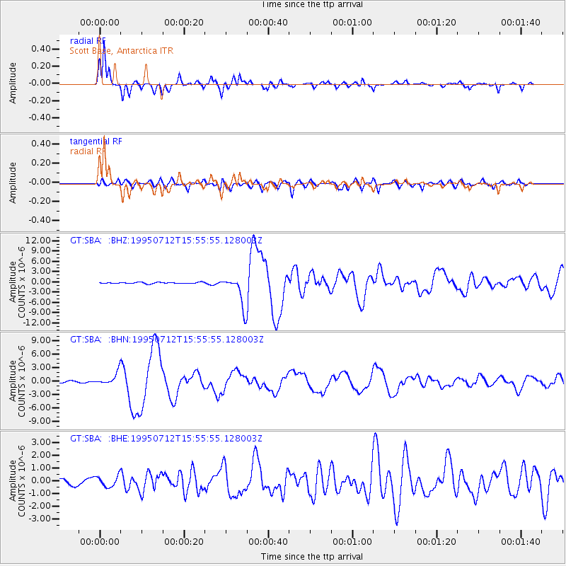
Signal To Noise
| Channel | StoN | STA | LTA |
| GT:SBA: :BHN:19950712T15:55:55.128003Z | 9.395566 | 1.4767712E-6 | 1.5717747E-7 |
| GT:SBA: :BHE:19950712T15:55:55.128003Z | 2.0628693 | 4.3366487E-7 | 2.102241E-7 |
| GT:SBA: :BHZ:19950712T15:55:55.128003Z | 25.044369 | 4.6684627E-6 | 1.8640768E-7 |
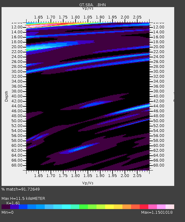
| Arrivals | |
| Ps | 1.2 SECOND |
| PpPs | 4.6 SECOND |
| PsPs/PpSs | 5.8 SECOND |

