You are here: Home > Network List > GS - US Geological Survey Networks Stations List
> Station KAN10 Keim Farm > Earthquake Result Viewer
KAN10 Keim Farm - Earthquake Result Viewer
*The percent match for this event was below the threshold and hence no stack was calculated.
| Earthquake location: |
Off Coast Of Peru |
| Earthquake latitude/longitude: |
-17.9/-73.4 |
| Earthquake time(UTC): |
2014/07/14 (195) 11:24:39 GMT |
| Earthquake Depth: |
33 km |
| Earthquake Magnitude: |
5.5 M |
| Earthquake Catalog/Contributor: |
NEIC PDE/NEIC ALERT |
|
| Network: |
GS US Geological Survey Networks |
| Station: |
KAN10 Keim Farm |
| Lat/Lon: |
37.12 N/98.10 W |
| Elevation: |
417 m |
|
| Distance: |
59.5 deg |
| Az: |
337.213 deg |
| Baz: |
152.526 deg |
| Ray Param: |
$rayparam |
*The percent match for this event was below the threshold and hence was not used in the summary stack. |
|
| Radial Match: |
51.885616 % |
| Radial Bump: |
400 |
| Transverse Match: |
39.07033 % |
| Transverse Bump: |
400 |
| SOD ConfigId: |
3390531 |
| Insert Time: |
2019-04-12 20:54:14.405 +0000 |
| GWidth: |
2.5 |
| Max Bumps: |
400 |
| Tol: |
0.001 |
|
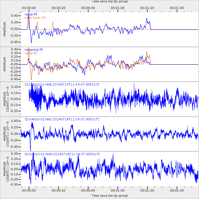
Signal To Noise
| Channel | StoN | STA | LTA |
| GS:KAN10:01:HHZ:20140714T11:34:07.905017Z | 2.4441252 | 1.9957206E-7 | 8.165377E-8 |
| GS:KAN10:01:HHN:20140714T11:34:07.905017Z | 2.28063 | 1.7651702E-7 | 7.7398354E-8 |
| GS:KAN10:01:HHE:20140714T11:34:07.905017Z | 0.8551814 | 7.691783E-8 | 8.9943285E-8 |
| Arrivals |
| Ps | |
| PpPs | |
| PsPs/PpSs | |


