You are here: Home > Network List > TA - USArray Transportable Network (new EarthScope stations) Stations List
> Station R49A Shelbyville, KY, USA > Earthquake Result Viewer
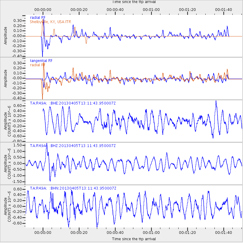
R49A Shelbyville, KY, USA - Earthquake Result Viewer
*The percent match for this event was below the threshold and hence no stack was calculated.
| Earthquake location: |
E. Russia-N.E. China Border Reg. |
| Earthquake latitude/longitude: |
42.7/131.0 |
| Earthquake time(UTC): |
2013/04/05 (095) 13:00:02 GMT |
| Earthquake Depth: |
563 km |
| Earthquake Magnitude: |
6.3 MW, 6.2 MB, 6.4 MW |
| Earthquake Catalog/Contributor: |
NEIC PDE/NEIC PDE-W |
|
| Network: |
TA USArray Transportable Network (new EarthScope stations) |
| Station: |
R49A Shelbyville, KY, USA |
| Lat/Lon: |
38.29 N/85.17 W |
| Elevation: |
251 m |
|
| Distance: |
92.9 deg |
| Az: |
27.714 deg |
| Baz: |
334.188 deg |
| Ray Param: |
$rayparam |
*The percent match for this event was below the threshold and hence was not used in the summary stack. |
|
| Radial Match: |
66.482605 % |
| Radial Bump: |
400 |
| Transverse Match: |
53.44538 % |
| Transverse Bump: |
400 |
| SOD ConfigId: |
512894 |
| Insert Time: |
2013-09-13 00:20:30.923 +0000 |
| GWidth: |
2.5 |
| Max Bumps: |
400 |
| Tol: |
0.001 |
|
Signal To Noise
| Channel | StoN | STA | LTA |
| TA:R49A: :BHZ:20130405T13:11:43.950007Z | 1.7290671 | 8.171506E-7 | 4.725962E-7 |
| TA:R49A: :BHN:20130405T13:11:43.950007Z | 0.7157729 | 2.1755794E-7 | 3.0394827E-7 |
| TA:R49A: :BHE:20130405T13:11:43.950007Z | 0.7593417 | 2.3235785E-7 | 3.0599904E-7 |
| Arrivals |
| Ps | |
| PpPs | |
| PsPs/PpSs | |


