You are here: Home > Network List > CN - Canadian National Seismograph Network Stations List
> Station INK INUVIK, NT > Earthquake Result Viewer
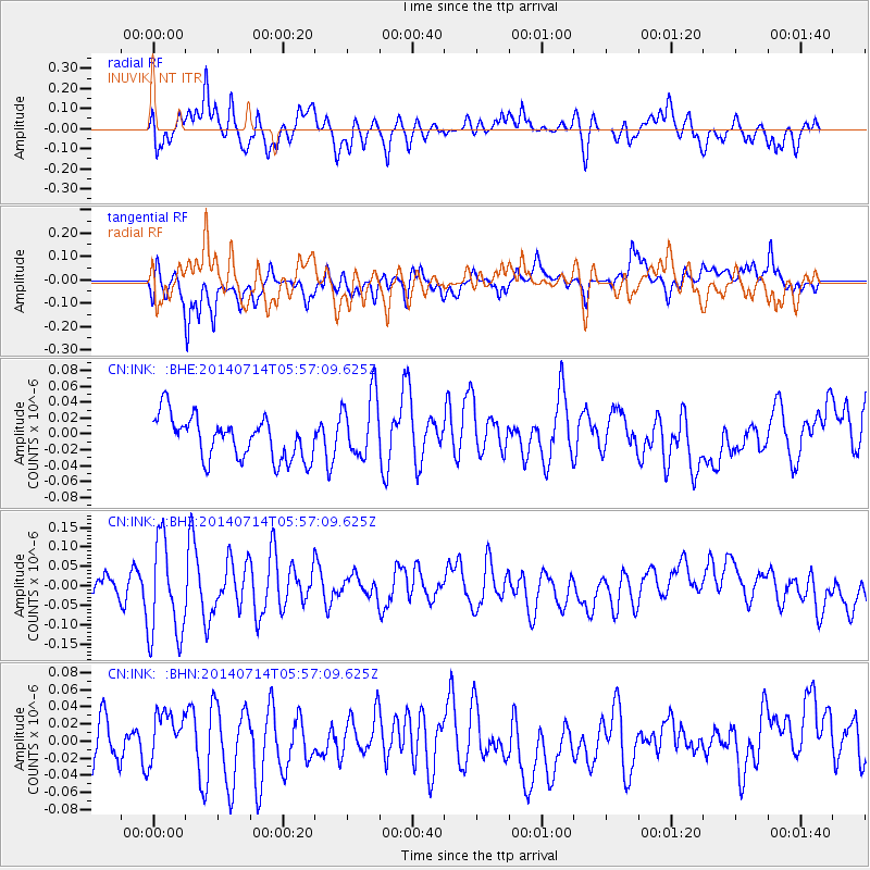
INK INUVIK, NT - Earthquake Result Viewer
*The percent match for this event was below the threshold and hence no stack was calculated.
| Earthquake location: |
Easter Island Region |
| Earthquake latitude/longitude: |
-26.7/-114.5 |
| Earthquake time(UTC): |
2014/07/14 (195) 05:44:16 GMT |
| Earthquake Depth: |
15 km |
| Earthquake Magnitude: |
5.5 MW, 5.4 mB, 5.3 Ms, 5.0 Ms7 |
| Earthquake Catalog/Contributor: |
ISC/ISC |
|
| Network: |
CN Canadian National Seismograph Network |
| Station: |
INK INUVIK, NT |
| Lat/Lon: |
68.31 N/133.53 W |
| Elevation: |
44 m |
|
| Distance: |
95.8 deg |
| Az: |
353.003 deg |
| Baz: |
162.956 deg |
| Ray Param: |
$rayparam |
*The percent match for this event was below the threshold and hence was not used in the summary stack. |
|
| Radial Match: |
69.19207 % |
| Radial Bump: |
400 |
| Transverse Match: |
60.89448 % |
| Transverse Bump: |
400 |
| SOD ConfigId: |
3390531 |
| Insert Time: |
2019-04-12 21:20:52.770 +0000 |
| GWidth: |
2.5 |
| Max Bumps: |
400 |
| Tol: |
0.001 |
|
Signal To Noise
| Channel | StoN | STA | LTA |
| CN:INK: :BHZ:20140714T05:57:09.625Z | 2.983267 | 1.2593715E-7 | 4.221451E-8 |
| CN:INK: :BHN:20140714T05:57:09.625Z | 1.1956418 | 3.260467E-8 | 2.7269598E-8 |
| CN:INK: :BHE:20140714T05:57:09.625Z | 1.5498782 | 4.1304414E-8 | 2.6650103E-8 |
| Arrivals |
| Ps | |
| PpPs | |
| PsPs/PpSs | |


