You are here: Home > Network List > US - United States National Seismic Network Stations List
> Station DGMT Dagmar, Montana, USA > Earthquake Result Viewer
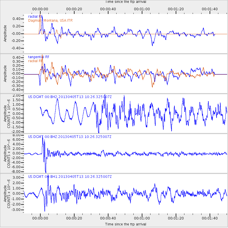
DGMT Dagmar, Montana, USA - Earthquake Result Viewer
*The percent match for this event was below the threshold and hence no stack was calculated.
| Earthquake location: |
E. Russia-N.E. China Border Reg. |
| Earthquake latitude/longitude: |
42.7/131.0 |
| Earthquake time(UTC): |
2013/04/05 (095) 13:00:02 GMT |
| Earthquake Depth: |
563 km |
| Earthquake Magnitude: |
6.3 MW, 6.2 MB, 6.4 MW |
| Earthquake Catalog/Contributor: |
NEIC PDE/NEIC PDE-W |
|
| Network: |
US United States National Seismic Network |
| Station: |
DGMT Dagmar, Montana, USA |
| Lat/Lon: |
48.47 N/104.20 W |
| Elevation: |
0.0 m |
|
| Distance: |
77.0 deg |
| Az: |
34.113 deg |
| Baz: |
321.62 deg |
| Ray Param: |
$rayparam |
*The percent match for this event was below the threshold and hence was not used in the summary stack. |
|
| Radial Match: |
66.21886 % |
| Radial Bump: |
400 |
| Transverse Match: |
69.85242 % |
| Transverse Bump: |
400 |
| SOD ConfigId: |
512894 |
| Insert Time: |
2013-09-13 00:26:17.770 +0000 |
| GWidth: |
2.5 |
| Max Bumps: |
400 |
| Tol: |
0.001 |
|
Signal To Noise
| Channel | StoN | STA | LTA |
| US:DGMT:00:BHZ:20130405T13:10:26.325007Z | 17.543964 | 3.5098153E-6 | 2.0005828E-7 |
| US:DGMT:00:BH1:20130405T13:10:26.325007Z | 3.6156404 | 1.404599E-6 | 3.884786E-7 |
| US:DGMT:00:BH2:20130405T13:10:26.325007Z | 1.3839792 | 9.818044E-7 | 7.0940695E-7 |
| Arrivals |
| Ps | |
| PpPs | |
| PsPs/PpSs | |


