You are here: Home > Network List > GS - US Geological Survey Networks Stations List
> Station KAN13 Rinehart Farm > Earthquake Result Viewer
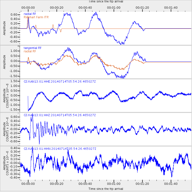
KAN13 Rinehart Farm - Earthquake Result Viewer
*The percent match for this event was below the threshold and hence no stack was calculated.
| Earthquake location: |
Easter Island Region |
| Earthquake latitude/longitude: |
-26.7/-114.5 |
| Earthquake time(UTC): |
2014/07/14 (195) 05:44:16 GMT |
| Earthquake Depth: |
15 km |
| Earthquake Magnitude: |
5.5 MW, 5.4 mB, 5.3 Ms, 5.0 Ms7 |
| Earthquake Catalog/Contributor: |
ISC/ISC |
|
| Network: |
GS US Geological Survey Networks |
| Station: |
KAN13 Rinehart Farm |
| Lat/Lon: |
37.01 N/97.48 W |
| Elevation: |
340 m |
|
| Distance: |
65.4 deg |
| Az: |
14.938 deg |
| Baz: |
196.744 deg |
| Ray Param: |
$rayparam |
*The percent match for this event was below the threshold and hence was not used in the summary stack. |
|
| Radial Match: |
46.992527 % |
| Radial Bump: |
400 |
| Transverse Match: |
54.868645 % |
| Transverse Bump: |
400 |
| SOD ConfigId: |
3390531 |
| Insert Time: |
2019-04-12 21:21:43.700 +0000 |
| GWidth: |
2.5 |
| Max Bumps: |
400 |
| Tol: |
0.001 |
|
Signal To Noise
| Channel | StoN | STA | LTA |
| GS:KAN13:01:HHZ:20140714T05:54:26.465027Z | 8.377741 | 3.616107E-7 | 4.3163272E-8 |
| GS:KAN13:01:HHN:20140714T05:54:26.465027Z | 2.0925677 | 2.4192494E-7 | 1.1561153E-7 |
| GS:KAN13:01:HHE:20140714T05:54:26.465027Z | 0.58444846 | 3.1097923E-7 | 5.320901E-7 |
| Arrivals |
| Ps | |
| PpPs | |
| PsPs/PpSs | |


