You are here: Home > Network List > AZ - ANZA Regional Network Stations List
> Station SMER AZ.SMER > Earthquake Result Viewer
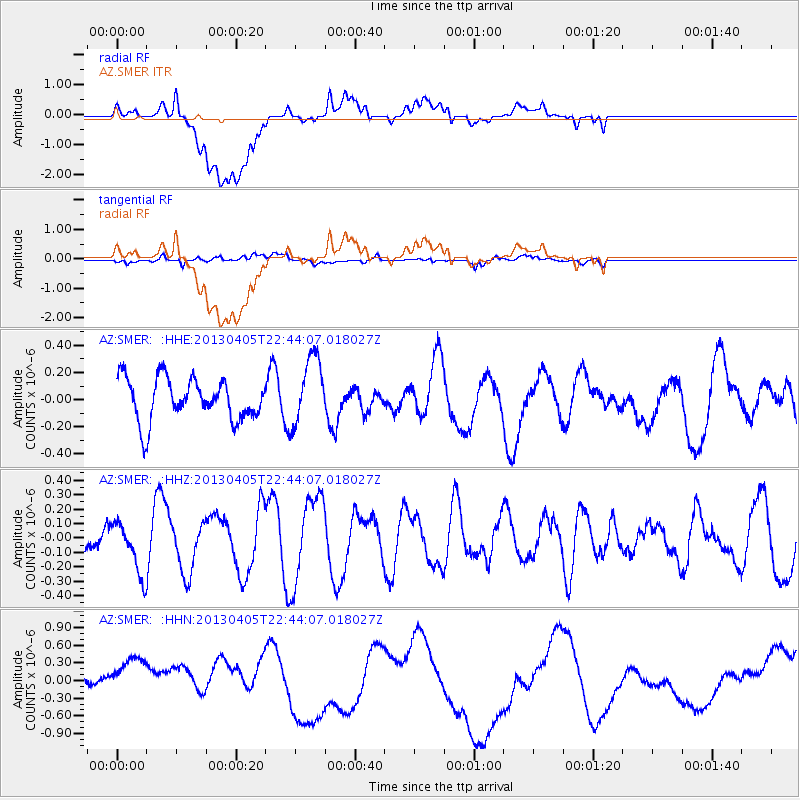
SMER AZ.SMER - Earthquake Result Viewer
*The percent match for this event was below the threshold and hence no stack was calculated.
| Earthquake location: |
Southern East Pacific Rise |
| Earthquake latitude/longitude: |
-55.8/-124.3 |
| Earthquake time(UTC): |
2013/04/05 (095) 22:31:45 GMT |
| Earthquake Depth: |
24 km |
| Earthquake Magnitude: |
5.5 MW |
| Earthquake Catalog/Contributor: |
NEIC PDE/NEIC PDE-W |
|
| Network: |
AZ ANZA Regional Network |
| Station: |
SMER AZ.SMER |
| Lat/Lon: |
33.46 N/117.17 W |
| Elevation: |
355 m |
|
| Distance: |
89.1 deg |
| Az: |
5.931 deg |
| Baz: |
184.002 deg |
| Ray Param: |
$rayparam |
*The percent match for this event was below the threshold and hence was not used in the summary stack. |
|
| Radial Match: |
35.934166 % |
| Radial Bump: |
400 |
| Transverse Match: |
45.093742 % |
| Transverse Bump: |
400 |
| SOD ConfigId: |
512894 |
| Insert Time: |
2013-09-13 00:47:39.266 +0000 |
| GWidth: |
2.5 |
| Max Bumps: |
400 |
| Tol: |
0.001 |
|
Signal To Noise
| Channel | StoN | STA | LTA |
| AZ:SMER: :HHZ:20130405T22:44:07.018027Z | 1.4041154 | 1.7820383E-7 | 1.2691537E-7 |
| AZ:SMER: :HHN:20130405T22:44:07.018027Z | 1.2247427 | 6.704426E-7 | 5.474151E-7 |
| AZ:SMER: :HHE:20130405T22:44:07.018027Z | 1.62901 | 2.5361095E-7 | 1.556841E-7 |
| Arrivals |
| Ps | |
| PpPs | |
| PsPs/PpSs | |


