You are here: Home > Network List > CN - Canadian National Seismograph Network Stations List
> Station INK INUVIK, NT > Earthquake Result Viewer
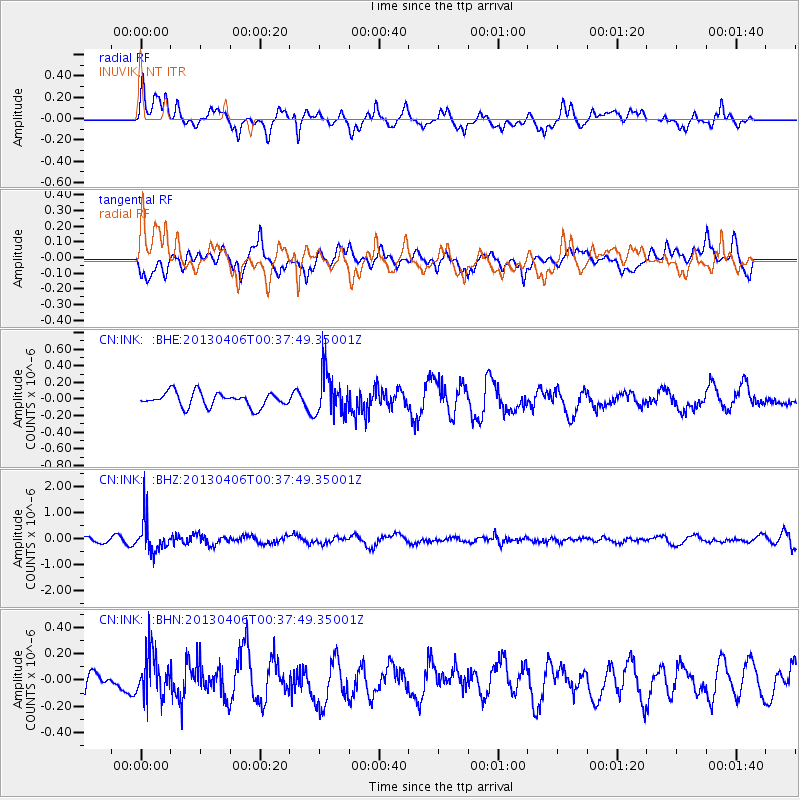
INK INUVIK, NT - Earthquake Result Viewer
*The percent match for this event was below the threshold and hence no stack was calculated.
| Earthquake location: |
E. Russia-N.E. China Border Reg. |
| Earthquake latitude/longitude: |
42.7/131.0 |
| Earthquake time(UTC): |
2013/04/06 (096) 00:29:55 GMT |
| Earthquake Depth: |
563 km |
| Earthquake Magnitude: |
5.8 MW, 5.5 MB, 5.9 MW |
| Earthquake Catalog/Contributor: |
NEIC PDE/NEIC PDE-W |
|
| Network: |
CN Canadian National Seismograph Network |
| Station: |
INK INUVIK, NT |
| Lat/Lon: |
68.31 N/133.53 W |
| Elevation: |
44 m |
|
| Distance: |
53.0 deg |
| Az: |
27.592 deg |
| Baz: |
293.366 deg |
| Ray Param: |
$rayparam |
*The percent match for this event was below the threshold and hence was not used in the summary stack. |
|
| Radial Match: |
74.522354 % |
| Radial Bump: |
400 |
| Transverse Match: |
48.10182 % |
| Transverse Bump: |
400 |
| SOD ConfigId: |
512894 |
| Insert Time: |
2013-09-13 01:23:39.577 +0000 |
| GWidth: |
2.5 |
| Max Bumps: |
400 |
| Tol: |
0.001 |
|
Signal To Noise
| Channel | StoN | STA | LTA |
| CN:INK: :BHZ:20130406T00:37:49.35001Z | 7.986302 | 6.4923586E-7 | 8.129368E-8 |
| CN:INK: :BHN:20130406T00:37:49.35001Z | 1.8586617 | 1.7502546E-7 | 9.416747E-8 |
| CN:INK: :BHE:20130406T00:37:49.35001Z | 3.0415344 | 2.6138028E-7 | 8.5936975E-8 |
| Arrivals |
| Ps | |
| PpPs | |
| PsPs/PpSs | |


