You are here: Home > Network List > US - United States National Seismic Network Stations List
> Station HAWA Hanford, Washington, USA > Earthquake Result Viewer
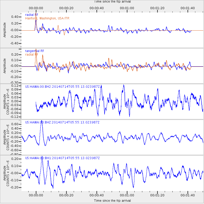
HAWA Hanford, Washington, USA - Earthquake Result Viewer
*The percent match for this event was below the threshold and hence no stack was calculated.
| Earthquake location: |
Easter Island Region |
| Earthquake latitude/longitude: |
-26.7/-114.5 |
| Earthquake time(UTC): |
2014/07/14 (195) 05:44:16 GMT |
| Earthquake Depth: |
15 km |
| Earthquake Magnitude: |
5.5 MW, 5.4 mB, 5.3 Ms, 5.0 Ms7 |
| Earthquake Catalog/Contributor: |
ISC/ISC |
|
| Network: |
US United States National Seismic Network |
| Station: |
HAWA Hanford, Washington, USA |
| Lat/Lon: |
46.39 N/119.53 W |
| Elevation: |
364 m |
|
| Distance: |
72.9 deg |
| Az: |
356.358 deg |
| Baz: |
175.29 deg |
| Ray Param: |
$rayparam |
*The percent match for this event was below the threshold and hence was not used in the summary stack. |
|
| Radial Match: |
65.81286 % |
| Radial Bump: |
400 |
| Transverse Match: |
45.25116 % |
| Transverse Bump: |
400 |
| SOD ConfigId: |
3390531 |
| Insert Time: |
2019-04-12 21:29:35.722 +0000 |
| GWidth: |
2.5 |
| Max Bumps: |
400 |
| Tol: |
0.001 |
|
Signal To Noise
| Channel | StoN | STA | LTA |
| US:HAWA:00:BHZ:20140714T05:55:13.023987Z | 5.1412635 | 3.8027179E-7 | 7.396465E-8 |
| US:HAWA:00:BH1:20140714T05:55:13.023987Z | 2.9763355 | 1.053888E-7 | 3.5408913E-8 |
| US:HAWA:00:BH2:20140714T05:55:13.023987Z | 0.74100024 | 2.5797274E-8 | 3.4814125E-8 |
| Arrivals |
| Ps | |
| PpPs | |
| PsPs/PpSs | |


