You are here: Home > Network List > TA - USArray Transportable Network (new EarthScope stations) Stations List
> Station D41A Chassel, MI, USA > Earthquake Result Viewer
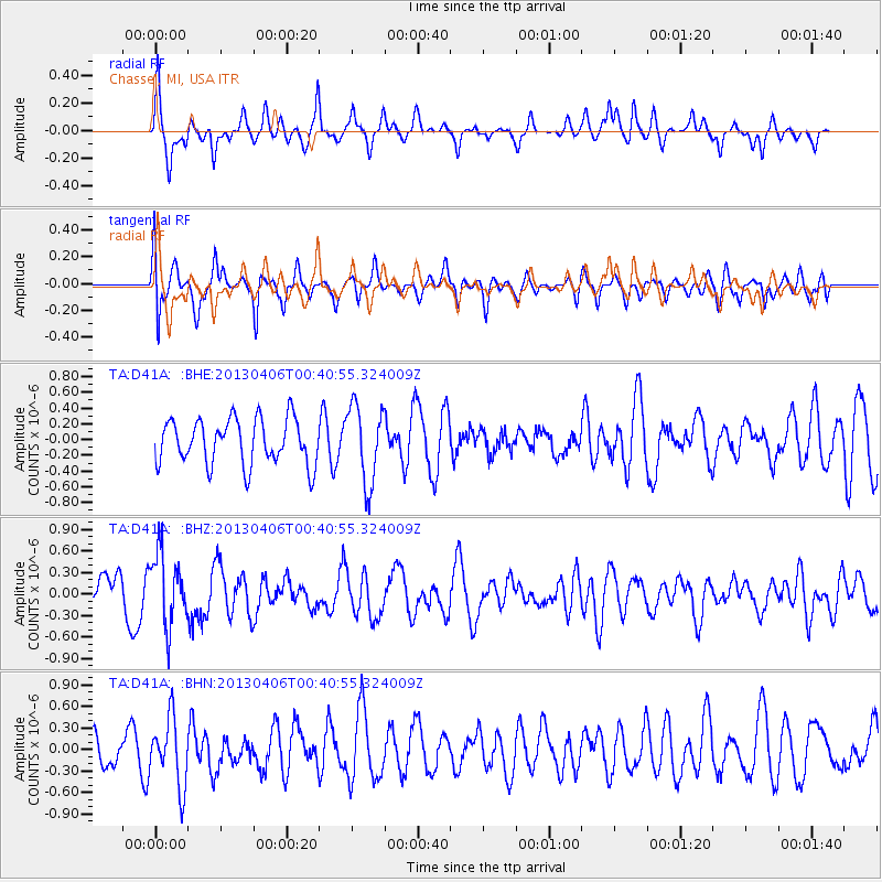
D41A Chassel, MI, USA - Earthquake Result Viewer
*The percent match for this event was below the threshold and hence no stack was calculated.
| Earthquake location: |
E. Russia-N.E. China Border Reg. |
| Earthquake latitude/longitude: |
42.7/131.0 |
| Earthquake time(UTC): |
2013/04/06 (096) 00:29:55 GMT |
| Earthquake Depth: |
563 km |
| Earthquake Magnitude: |
5.8 MW, 5.5 MB, 5.9 MW |
| Earthquake Catalog/Contributor: |
NEIC PDE/NEIC PDE-W |
|
| Network: |
TA USArray Transportable Network (new EarthScope stations) |
| Station: |
D41A Chassel, MI, USA |
| Lat/Lon: |
47.06 N/88.57 W |
| Elevation: |
271 m |
|
| Distance: |
84.0 deg |
| Az: |
25.955 deg |
| Baz: |
331.854 deg |
| Ray Param: |
$rayparam |
*The percent match for this event was below the threshold and hence was not used in the summary stack. |
|
| Radial Match: |
68.84709 % |
| Radial Bump: |
311 |
| Transverse Match: |
50.478996 % |
| Transverse Bump: |
400 |
| SOD ConfigId: |
512894 |
| Insert Time: |
2013-09-13 01:43:57.988 +0000 |
| GWidth: |
2.5 |
| Max Bumps: |
400 |
| Tol: |
0.001 |
|
Signal To Noise
| Channel | StoN | STA | LTA |
| TA:D41A: :BHZ:20130406T00:40:55.324009Z | 2.0977175 | 5.045416E-7 | 2.405193E-7 |
| TA:D41A: :BHN:20130406T00:40:55.324009Z | 2.0007775 | 4.6909585E-7 | 2.3445678E-7 |
| TA:D41A: :BHE:20130406T00:40:55.324009Z | 1.7291771 | 4.983032E-7 | 2.8817362E-7 |
| Arrivals |
| Ps | |
| PpPs | |
| PsPs/PpSs | |


