You are here: Home > Network List > UW - Pacific Northwest Regional Seismic Network Stations List
> Station LEBA Lebam, WA, USA > Earthquake Result Viewer
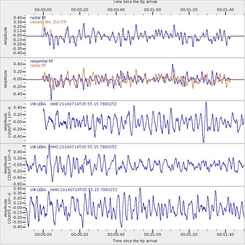
LEBA Lebam, WA, USA - Earthquake Result Viewer
*The percent match for this event was below the threshold and hence no stack was calculated.
| Earthquake location: |
Easter Island Region |
| Earthquake latitude/longitude: |
-26.7/-114.5 |
| Earthquake time(UTC): |
2014/07/14 (195) 05:44:16 GMT |
| Earthquake Depth: |
15 km |
| Earthquake Magnitude: |
5.5 MW, 5.4 mB, 5.3 Ms, 5.0 Ms7 |
| Earthquake Catalog/Contributor: |
ISC/ISC |
|
| Network: |
UW Pacific Northwest Regional Seismic Network |
| Station: |
LEBA Lebam, WA, USA |
| Lat/Lon: |
46.55 N/123.56 W |
| Elevation: |
73 m |
|
| Distance: |
73.4 deg |
| Az: |
353.484 deg |
| Baz: |
171.543 deg |
| Ray Param: |
$rayparam |
*The percent match for this event was below the threshold and hence was not used in the summary stack. |
|
| Radial Match: |
58.913643 % |
| Radial Bump: |
400 |
| Transverse Match: |
55.838463 % |
| Transverse Bump: |
400 |
| SOD ConfigId: |
3390531 |
| Insert Time: |
2019-04-12 21:30:31.765 +0000 |
| GWidth: |
2.5 |
| Max Bumps: |
400 |
| Tol: |
0.001 |
|
Signal To Noise
| Channel | StoN | STA | LTA |
| UW:LEBA: :HHZ:20140714T05:55:15.788025Z | 2.2447689 | 2.5827347E-7 | 1.15055705E-7 |
| UW:LEBA: :HHN:20140714T05:55:15.788025Z | 1.0416249 | 1.5139004E-7 | 1.4534027E-7 |
| UW:LEBA: :HHE:20140714T05:55:15.788025Z | 1.0154728 | 1.2675406E-7 | 1.248227E-7 |
| Arrivals |
| Ps | |
| PpPs | |
| PsPs/PpSs | |


